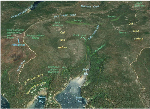
The sandstone and shale landscapes of the Sydney Basin contain some of the richest examples of indigenous occupation and examples of Aboriginal connection to Country anywhere in Australia. Evidence of Aboriginal occupation and use of the Georegion is found in more than 1400 sites, some of which have been dated to more than 3,500 years ago.
The sandstone plateau of the GeoRegion forms the foundation for the extensive Aboriginal engraving sites but also the intensive use of the area over thousands of years.
The Plateau, of Hawkesbury Sandstone and the Mittagong Formation form poorer soils than Ashfield Shale and yet support a rich and diverse array of flora that can be best seen across the GeoRegion in spring and summer.
Hawkesbury Sandstone dominates the scenery of the northern side of Sydney, including the, central part of the Ku-ring-gai GeoRegion. Aerially, it makes up more than 90% of Ku-ring-gai Chase National Park, creating rolling expanses of heathland and woodland cut by steep-sided valleys, gorges and drowned inlets. Its near coastal location and rugged terrain attracts good rainfall that partially compensates for the low fertility of its soils.
Learn More
Muogamarra Nature Reserve (22 mins)

