
The age of Hawkesbury Sandstone isn’t precisely known but is probably Middle Triassic within the brackets 247 to 242 million years. It’s up to 290 metres thick, but outcrops in the GeoRegion can be as thin as 50m. Most of the formation is medium to coarse-grained sandstone, with occasional beds of vein quartz pebbles or granules. Quartz is the dominant mineral of the sand grains, with subordinate claystone, feldspar species, white mica and flakes of graphite. The cement binding the grains is a combination of clays, siderite (iron carbonate), iron oxides and secondary silica. In surface outcrops, these cements have commonly been leached out or redistributed by deeply penetrating groundwaters, and rock outcrops are typically ‘case hardened’.
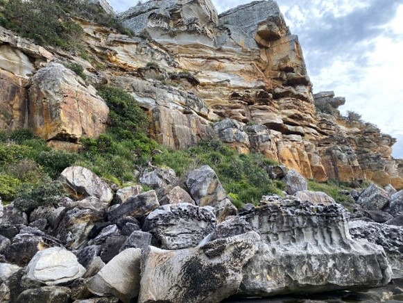
Photo: Hawkesbury Sandstone resting on Newport Formation of the Narrabeen Group, North Head below Shelly Headland
The sandstone takes two interlayered forms: massive and sheeted. Massive sandstones are in the general region of 3 to 8 metres in thickness and on cliff margins of tabletops and spurs they tend to form bluffs or buttresses with smooth, case-hardened crusts, locally tesselated, scored by runnels or rinnenkarren and undercut by caves and honeycomb weathering. The sheeted form, in contrast, is strongly layered, often pebbly, and features multiple sets of cross bedding. Flaggy sandstone and siltstone intervals leading to terraced hillside profiles are a characteristic feature of Hawkesbury Sandstone valley sides and slopes.
Photo: Bluff of massive Hawkesbury with case-hardened crust and sculpted by rainwater; South Turramurra
Mudrock intervals make up a small part of Hawkesbury Sandstone’s thickness, and are more prevalent towards its top. They consist of mudstone, shale, siltstone and laminite, often lenticular, and mostly less than 5 metres thick, though a large lens at Duffys Forest in the GeoRegion was measured up to 35 metres thick. With the formation of the Hawkesbury Sandstone as deposits of the floodplain of a vast braided river system or braid plain, the mudrock lenses fit in nicely as muddy floors of stranded lagoons or billabongs.
The GeoRegion contains an isolated shale lens at Beacon Hill whose 7 metre thickness was once quarried for ceramics, when it yielded an astonishing variety of fossil fish species. Such diversity is an indication of the expansive scale of the Hawkesbury Sandstone’s river system.
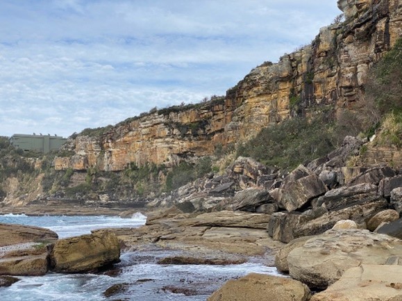
Photo: Sheeted sandstone 12 to 18 metres thick between two massive sandstone layers; North Head below Shelly Headland
Hawkesbury Sandstone dominates the scenery of the north side of the Sydney area too, including the main, central part of the Ku-ring-gai GeoRegion. Aerially, it makes up more than 90% of Ku-ring-gai Chase National Park, creating rolling expanses of heathland and woodland cut by steep-sided valleys, gorges and drowned inlets. Its near coastal location and rugged terrain attracts good rainfall that partially compensates for the low fertility of its soils.
Photo: Shale or mudstone interlayer overlain by sandstone; Beacon Hill

Some outcrop features of Hawkesbury Sandstone
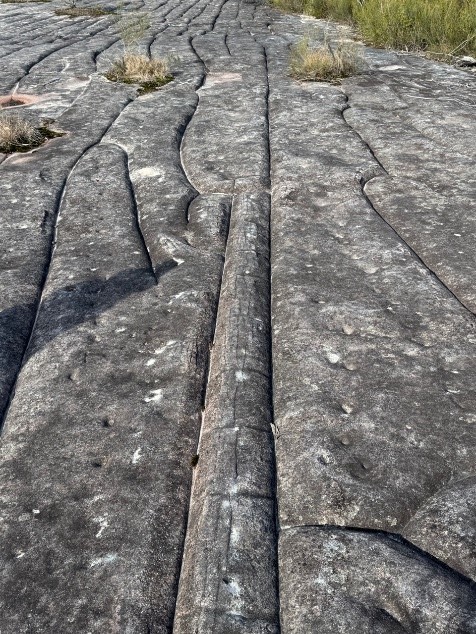
Bare rock platforms are a key feature of Hawkesbury Sandstone of the central part of the GeoRegion and a critical influence on their vegetation. These undulating rock pavements host a range of distinctive features related to a long history of interaction with rainfall, groundwater-movement and chemistry. The original Hawkesbury Sandstone sand on a vast river braid plain clearly had numerous unstable sandbanks and soggy sand flats subject to quicksand-like slumping which slumped and deformed under loading and shock forming anticlinal and synclinal slump folds , sheath folds and convoluted bedding.
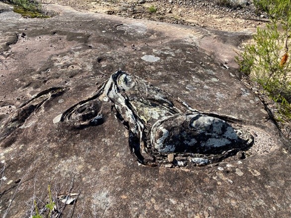
Photo: Complex anticlinal slump fold etch out on rock platform, Duckholes Trail
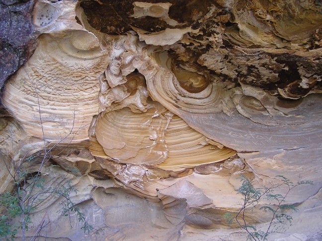
Over its geological history as sandstone, groundwater has penetrated to tens of metres depth, dissolving the sandstone’s ferrous carbonate cement, oxidising it to ferric iron and re-precipitating it into bands, seams and liesegang “onion ring” patterns of limonite, goethite and hematite. Exposed in caves and beneath overhangs this can feature fascinating visual patterns. Rainwater and groundwaters have also dissolved and carried silica to the surface evaporating to create case hardening, with smooth, rounded clifftops that have been eroded and undercut by drum caves and overhangs.
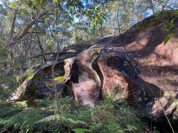
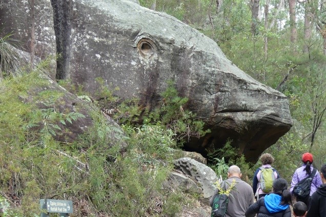
Photo: Whale Rock, North Epping; the “eye” is the etched out cross section of a sheath fold extending inward from the weathered face
Solution on rock platform surfaces by flowing and standing rainwater has created a multitude of varied dimples, cupules and shallow potholes. Mildly acidic water can seep from wet heath and etch runnels or rinnenkarren on gently to moderately sloping, case-hardened sandstone surfaces, especially those that drain from perched pockets of swamp or heath.
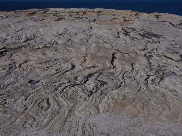
Photo: Convoluted bedding in Hawkesbury Sandstone clifftop, Kurnell Peninsula
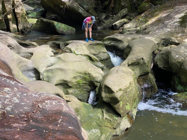
Karst-style potholing and tunneling is common along sandstone creeks, often forming near or above waterfalls, as pictured at the Washtubs on Waitara Creek in the GeoRegion.
Photo: Karst-type solution potholes at the Washtubs on Waitara Creek, Berowra Valley National Park
Ferruginous banding and incipient honeycomb weathering in a shallow sandstone cavern, Berowra.
Expansion/shrinkage tesselations are a striking feature of rock platforms in Ku-ring-gai Chase, Muogamarra and Garigal, and guaranteed to stop you in your tracks. These can align with joints and stress fractures but are often polygonal and random with no particular orientation. While baking by igneous intrusion can cause polygonal jointing in sandstone, this is very localised. Broadly tessellated rock platforms are not of this origin and are a superficial effect related to temperature and rainfall variations.
Tesselations etched out of sandstone platform and controlled by a major joint direction, Elvina trail, Ku-ring-gai Chase National Park
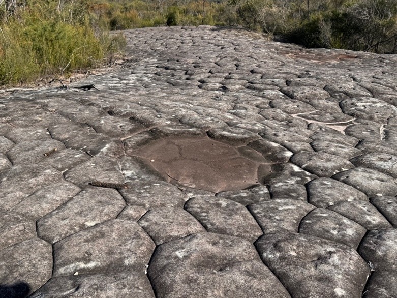
Polygonal tesselations etched on a sandstone platform and a shallow solution pan; Elvina trail, Ku-ring-gai Chase National Park