
Over the late-Pleistocene global sea levels had fallen to 125 metres below current levels. Then 20,000 years ago, as an Ice Age warmed up, they rose dramatically and drowned the winding river gorges to create the calm, dreamy, meandering waterways of our GeoRegion.
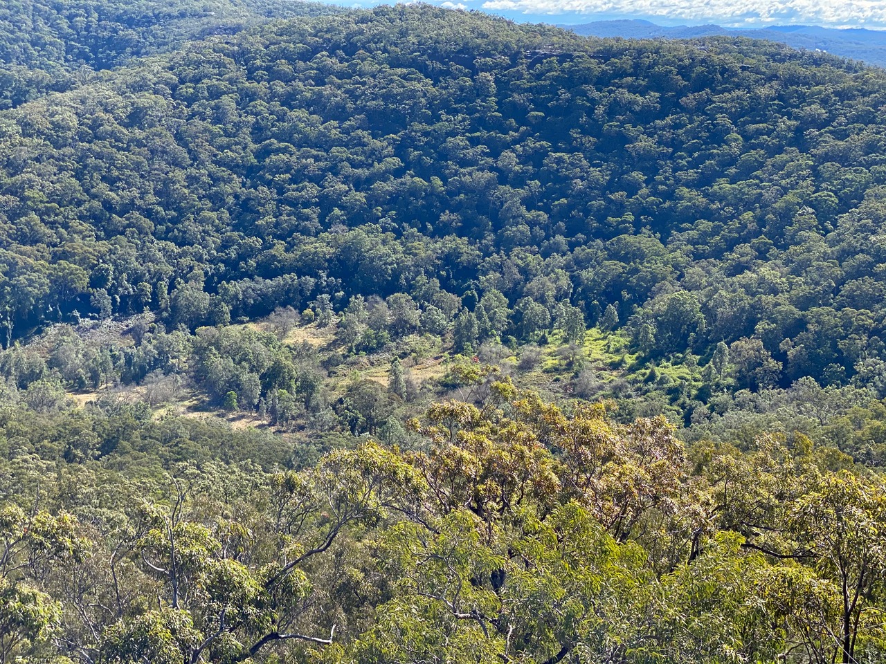
Our landscape was uplifted in the Miocene and Pliocene and even as late as Quaternary. Rivers that meandered across the old land surface became entrenched as winding gorges, the technical term for which is incised meanders, and this includes most of the larger streams in the Ku-ring-gai GeoRegion. Smaller tributary streams were stranded in shallow valleys on the tableland surfaces, their larger parents cutting down at a faster rate. They now flow to them via precipitous drops, either as tumbling rapids, a progression of small waterfalls or a single drop of several tens of metres, guided by the particular local character of the sandstone strata. These sharp breaks in slope marking the upstream progression of valley deepening are known as knickpoints and knickzones.
Sea levels rose and fell many times during the Quaternary glacial era, peaking in the previous interglacial period 125,000 years ago when the sea was 4 to 6 metres higher than today’s. Sea level again peaked around 1.75 metres above present around 6000 years ago but the critical factor is how low it went in geologically recent times – actually around 125 metres below present roughly 20,000 years ago.
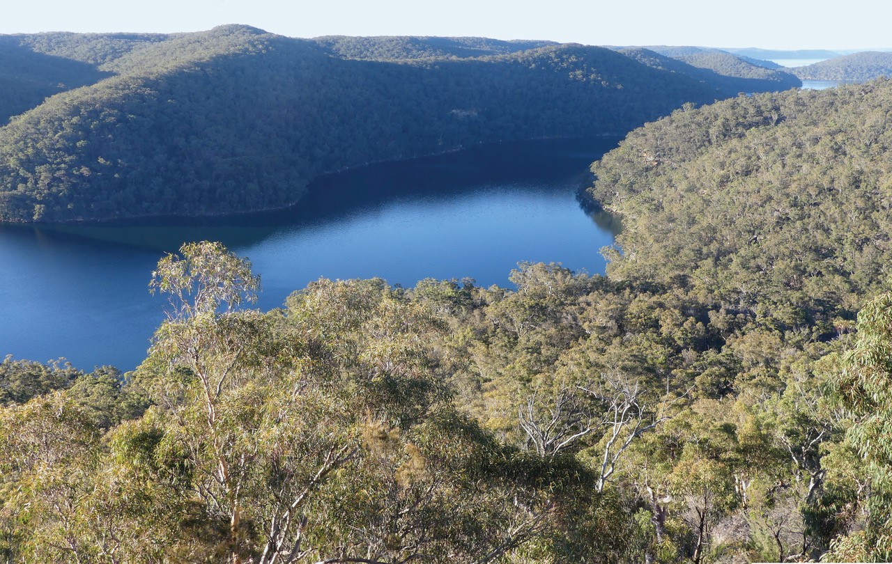
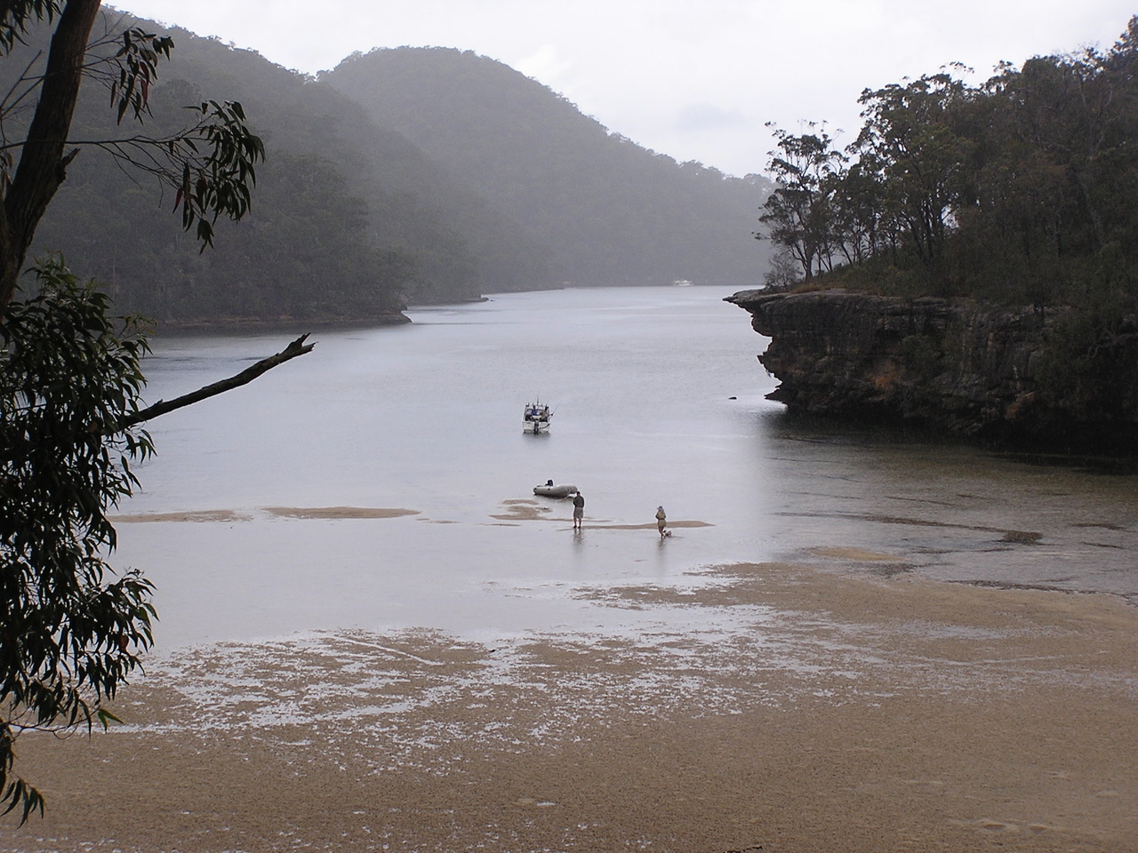
Berowra Creek is a classic, tidal drowned valley on the west side of the GeoRegion; here viewed looking upstream from high on a flanking hillside.

33º 06’ 24”S. 151º 07’ 30”E.
The vast expanse of Broken Bay is the drowned estuary of the Dyarubbin (Hawkesbury-Nepean) river system. The original river course is over 100 metres below current sea level, but that depth was not sustained as alluvial sand filled the valley following the sea level rise. Severely shallowed, Broken Bay is inaccessible to large ships, unlike Port Jackson and Sydney Harbour.
33º 34’ 44”S. 151º 18’ 31”E.
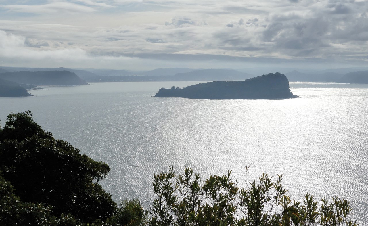
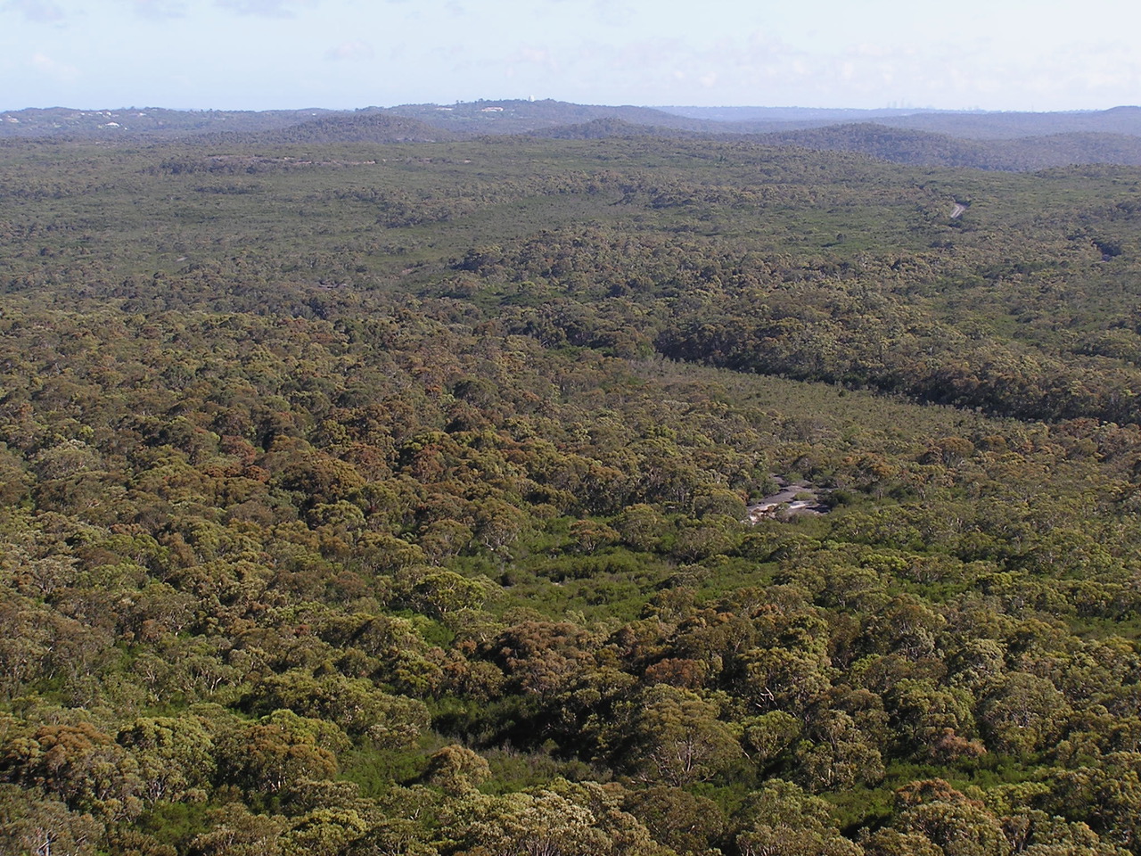
This viewpoint captures the landscape of the central part of the GeoRegion and pictures a terraced tableland of Hawkesbury Sandstone deeply incised by tidal Coal and Candle Creek.
33º 39’ 06”E. 151º 15’ 04”S.
Shallow and sand-filled, this view of Cockle Creek looking upstream is not far downstream of its tidal limit. Vegetation is lush and includes mangroves and galley rainforest.
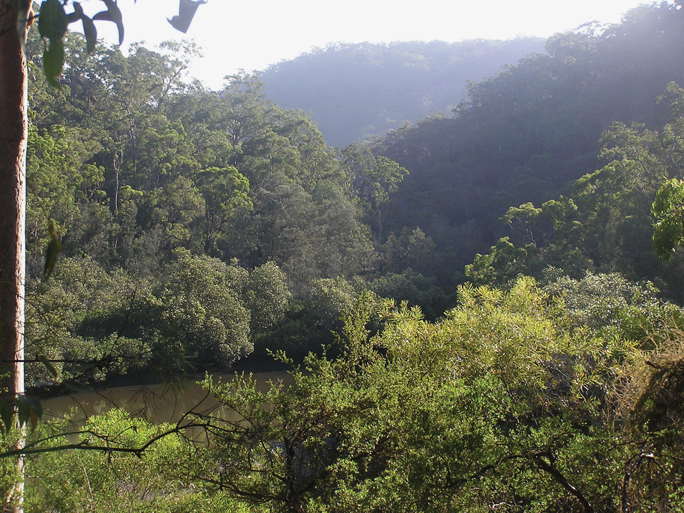
33º 39’ 50”S. 151º 09’20”E.
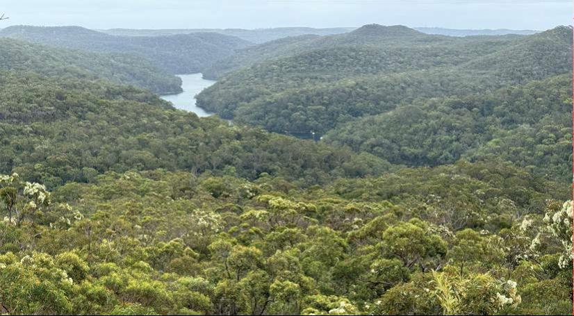
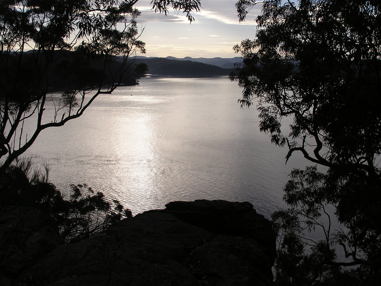
A longish walk of 10-12 km return, the Long Trail is a great wildflower walk and noted for its waratahs. The endpoint is a sweeping viewpoint that takes in the lower reaches of the Cowan Creek drowned valley system as it broadens towards the Hawkesbury estuary.
33º 37’ 23”S. 151º 11’ 20”E.
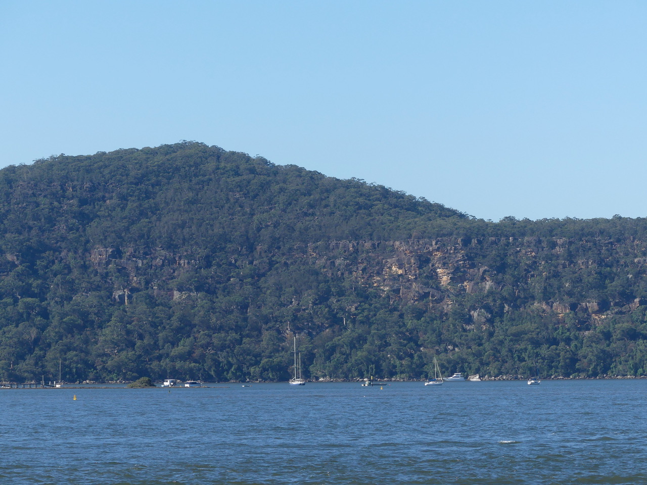
A water-level view towards the confluence of Coal and Candle with Cowan Creek. This is a popular tourist viewpoint. The water is deep close to shore and it's a good place to fish for hairtail at night in winter.

33º 38’ 05”S. 151º 13’ 23”E.
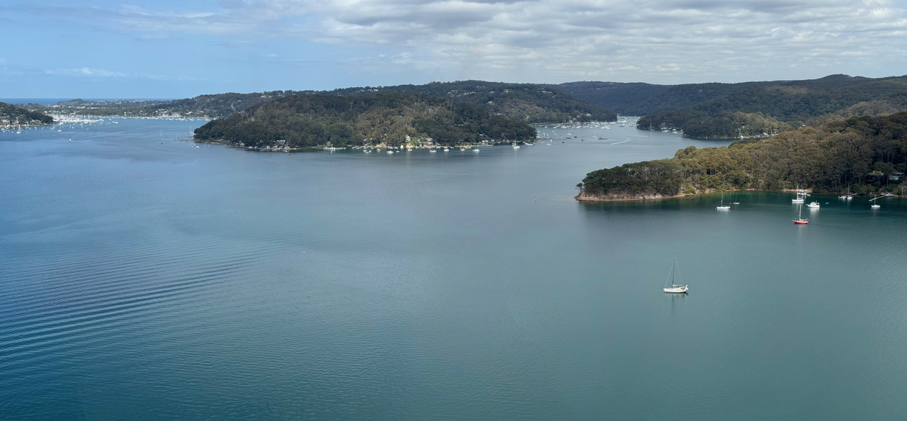
This is one of a number of views from points along the peninsula that fit this description. Pittwater is the most extensive drowned valley system in our GeoRegion and is popular for boating.
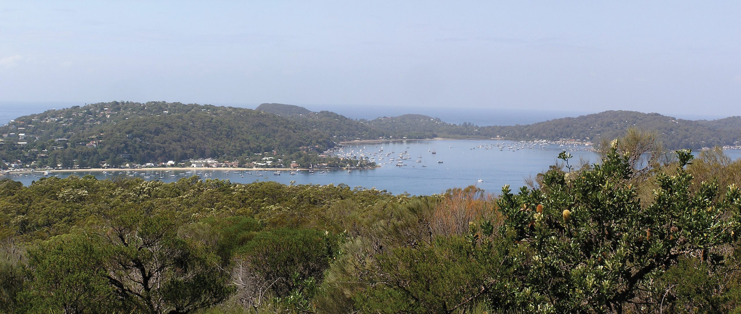
33º 34’ 50”S. 151º 17’ 59”E.
Muogamarra is a National Parks administered nature reserve and access to this viewpoint is restricted and requires booking or prearrangement (See details below). Peats Crater is a deeply eroded diatreme of probable Jurassic age that was once cleared and farmed. The name “crater” reflects its form but it certainly isn't a true volcanic crater.
33º 32’ 42”S. 151º 10’ 42” E.
This isn’t a single viewpoint but captures views from a long stretch of public footpath along the shoreline from Brooklyn to Parsley Bay.
33º 19’ 40”S. 151º 49’ 33” E.
A delightful bushwalk especially in wildflower season. Jerusalem Bay is a sheltered arm of the Cowan Creek drowned valley system.
33º 35’ 25”S. 151º 11’ 34” E.
At 233 m Above Sea Level this prominent hill with walking track access is the highest point in Ku-ring-gai Chase National Park and provides almost 360 degree views across the park and beyond.
33º 37’ 06”S. 151º 15’ 32” E.
Accessible by a sometimes rough walking track, the waterfall is crested by a broad rock platform providing views across to the junction of Cowan Creek drowned valley system and the Hawkesbury estuary. The waterfall is a classic knickpoint where its stream tumbles away from plateau to sea level.
33º 35’ 52”S. 151º 15’ 51” E.
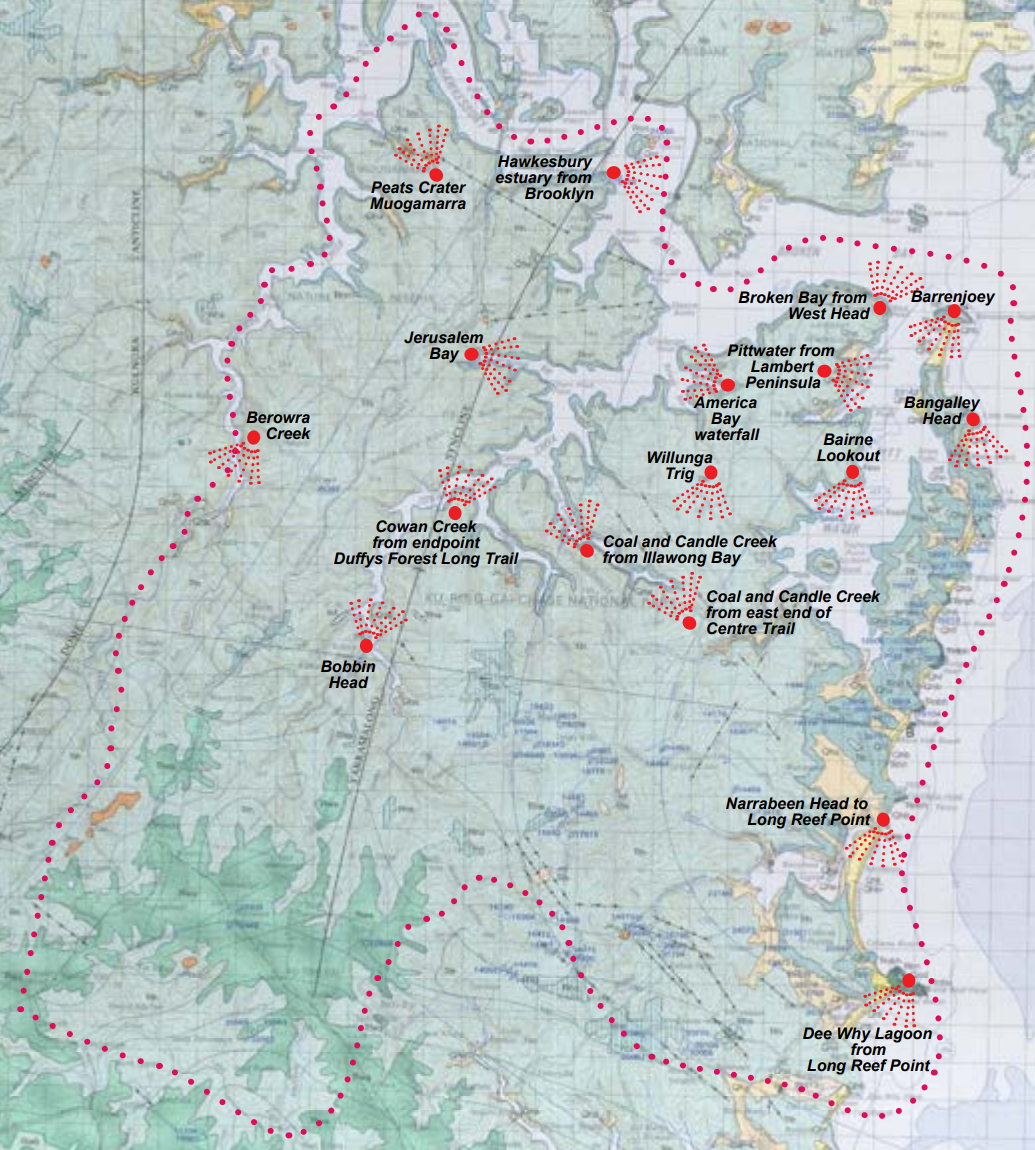
Barrenjoey is a tied island, a term used when a former island has become joined to the mainland by a sand spit known as a tombolo, which is central to the view.
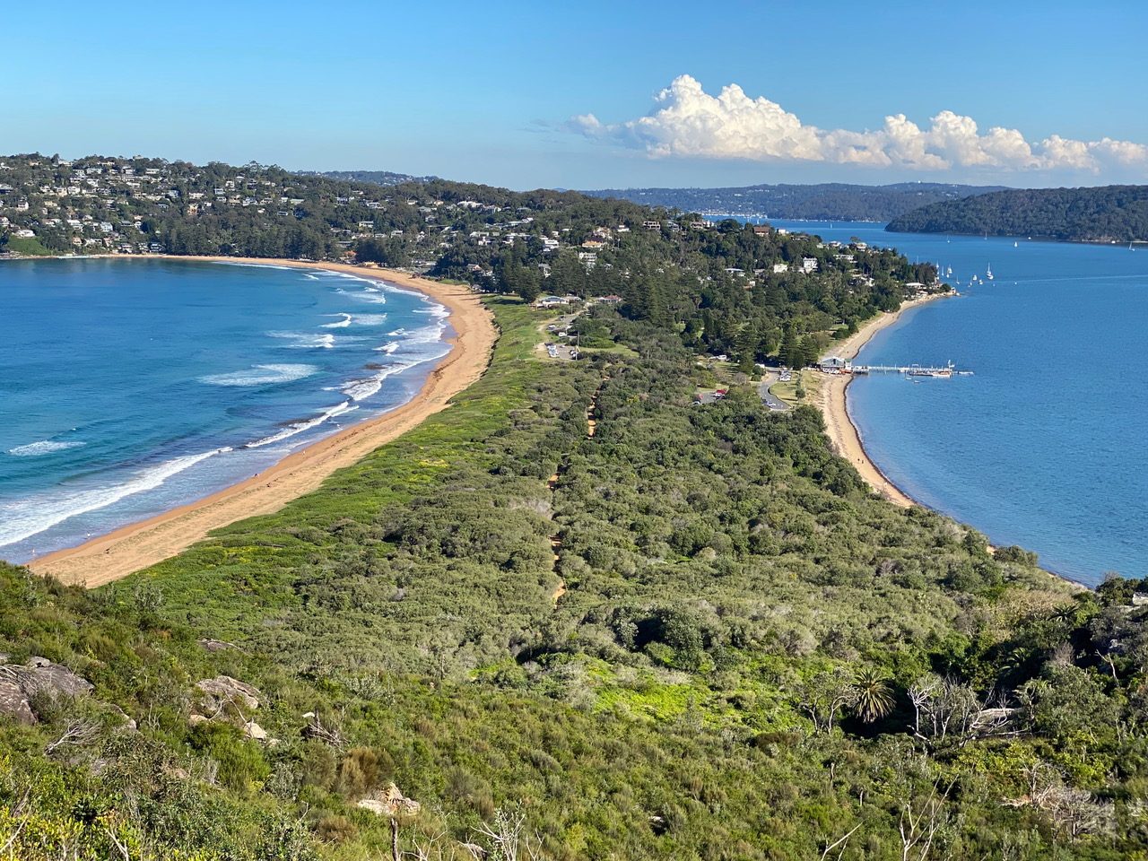
33º 34’ 49”S. 151º 19’ 43”E.
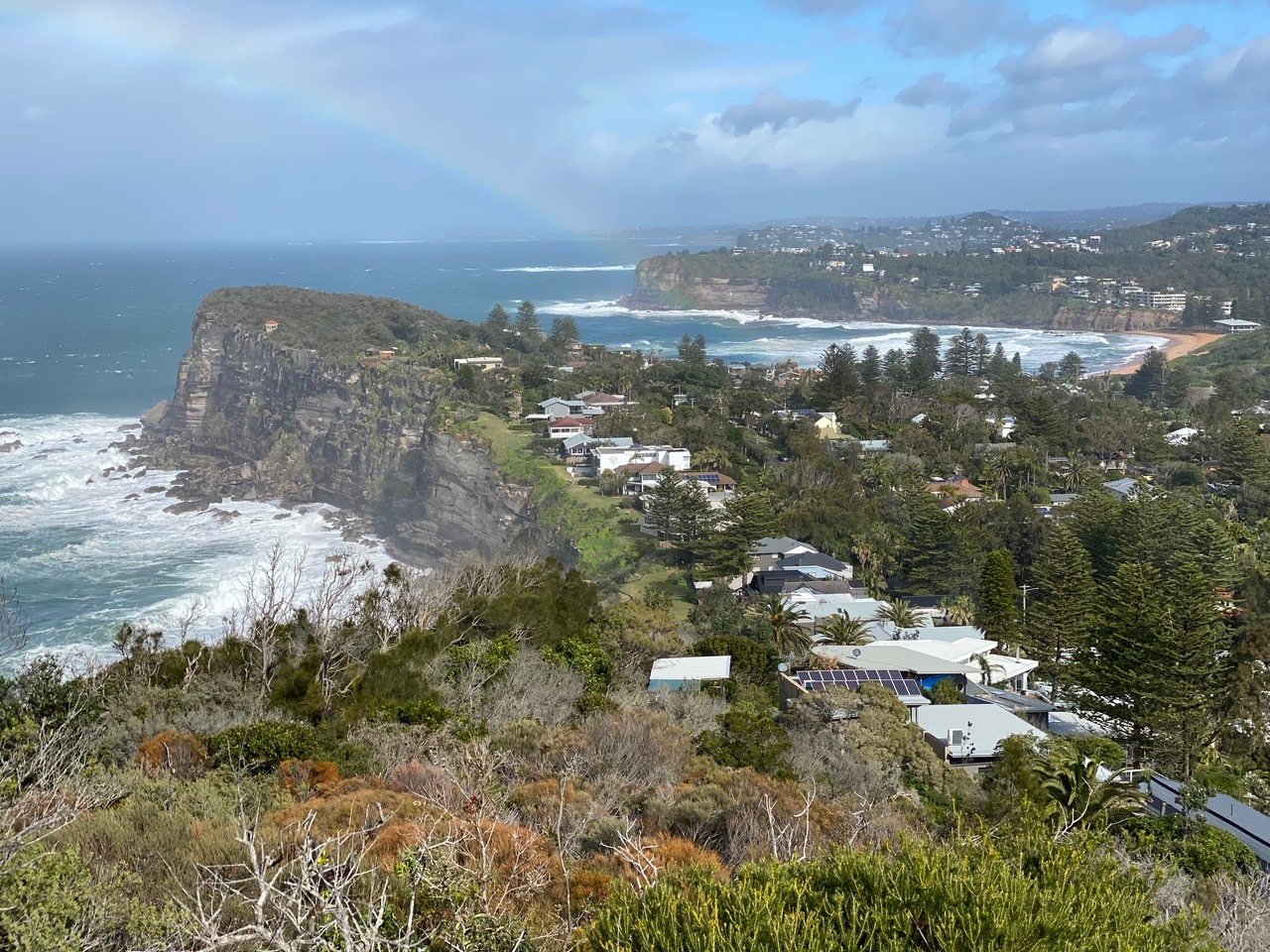
Bangalley head is the highest point on the Sydney coastline at 116 m Above Sea Level. It’s crowned by Hawkesbury Sandstone. This southward view embraces cliffs of sandstone of the Newport Formation, pounded in this picture by gales and waves from an east coast low. The west face of the point is a forest of leaning and twisted bangalleys, a canoe bark tree otherwise known as white mahogany or Eucalyptus umbra.
33º 37’ 29”S. 151º 20’ 26”E.
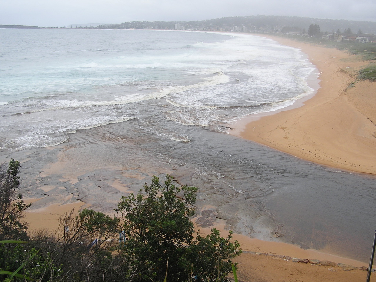
A short climb to a lookout brings a view southwards along a sweep of dune sand to the distant Long Reef Point. Narrabeen Lagoon entrance is at your feet and spectacular when surging with floodwaters.
33º 42’ 08”S. 151º 18’ 32”E.
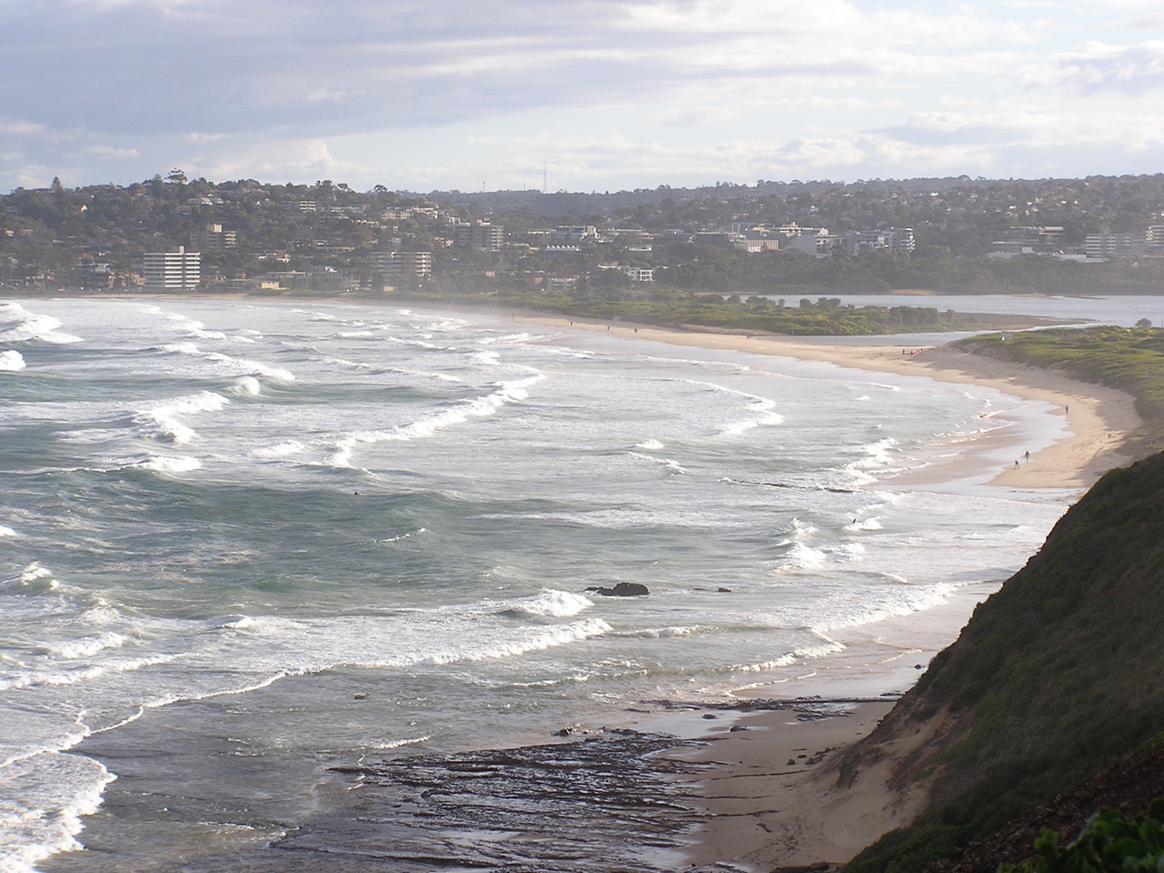
An easy walk to the summit of Long Reef Point gives you 360 degree views: great for whale watching and seeing ospreys catch their fish on the edge of the wave-washed rock platform. Lots of shorebird species visit this vast Long Reef seashore rock platform.
33º 44’ 31”S. 151º 18’ 52”E.
A three and a half kilometre walk with gentle grades brings you to a stunning view southwards to Scotland Island, McCarrs Creek and neighbouring inlets and the southern sweep of Pittwater.
33º37’16” S. 151º 37’ 16” E.
-
- Berowra Creek from Berowra walking track
-
- Coal and Candle Creek from east end of Centre Trail
-
- Cockle Creek looking upstream from Bobbin Head.
-
- Pittwater from West Head end of Lambert Peninsula
-
- Peats Crater diatreme from Muogamarra
-
- Hawkesbury Estuary from Brooklyn
-
- Jerusalem Bay
-
- Willunga Trig, Lambert Peninsula
-
- America Bay distant view
-
- Barrenjoey Headland south view
-
- Bangalley Head south view
-
- Narrabeen to Long Reef
-
- Long Reef Point to Dee Why lagoon
-
- Bairne Lookout
-
- Cowan Creek from turnaround point at end of Duffys Forest Long Trail
-
- Broken Bay with Lion Island from West Head
Access information
Most of these viewpoints are accessible all year around from existing lookouts or walking trails within Ku-ring-gai Chase National Park.
However, the Viewpoint within Muogamarra Nature Reserve (Peats Crater) is restricted to guided tours run by Chase Alive volunteers and National Parks & Wildlife Service (NPWS) guides usually held during August and September.
02 9472 9301