
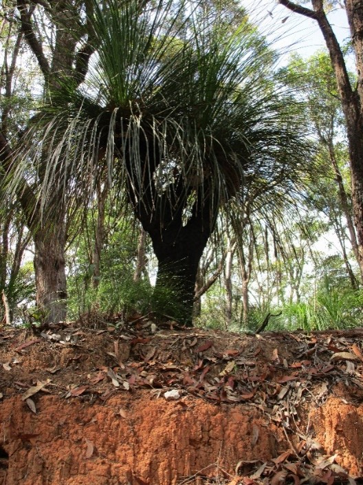
Located 32 km north of the Sydney CBD Lambert Peninsula separates Cowan Creek from Pittwater and ends at West Head with spectacular views overlooking the mouth of the Hawkesbury River. Geosites along West Head Road in Ku-ring-gai Chase National Park represent landscapes and geology of the upper part of the Triassic Hawkesbury Sandstone, a Jurassic age igneous dyke, and thick shale beds, all of which influence the vegetation which belongs to the Sydney Sandstone Complex and varies with topography, drainage, soil type, availability of phosphorous, and fire history.
Several geosites include Aboriginal heritage features. These places are protected by law and are particularly important to Aboriginal people, please treat them with respect. The names of the original Aboriginal groups living in this area are unclear. The strongest connections are with the Garigal, the Gai-Mariagal clans, there was no such tribal group as the Ku-ring-gai, as that word was invented in the late Nineteenth Century.
The rugged sandstone country was not suitable for agriculture and difficult to build roads through, therefore it remained undeveloped in the nineteenth century. Ku-ring-gai Chase was established in 1894, thanks to the vision of Eccleston Du Faur, and managed by a Trust until 1967 when the National Parks and Wildlife Service of New South Wales took over.
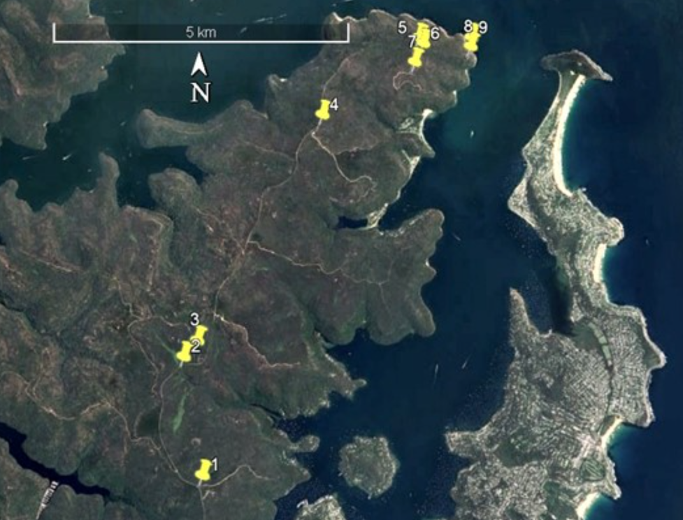
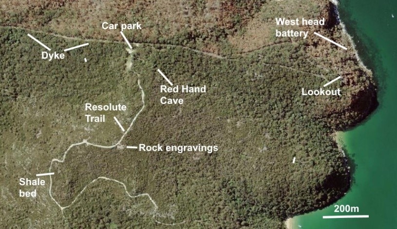
Geosite locations
The geosites are accessible from West Head Road and the starting locations are measured from the intersection of West Head Rd with Liberator General San Martin Drive. Car parking is limited. Toilets are available at the Resolute picnic area.
Click here for a West Head Geotrail PDF to download.
Click here to view the start of the West Head Geotrail on Google Maps


Geology
The Lambert Peninsula is capped by one of the best-known rock units in the Sydney basin – the Hawkesbury Sandstone of Triassic age (247 - 242 million years). A medium to coarse grained quartz sandstone with a clay matrix, the sequence includes thin beds of quartz pebble conglomerate, and lenses of shale that vary in thickness from a few centimetres to several metres. Two very different types of sandstone are present; thick homogenous units with little evidence of primary bedding (massive facies), and tabular units with distinct layering which is often cross bedded (sheet facies).
The sands were deposited in a large braided river system with headwaters in Antarctica when Sydney was at about latitude 600 South and Australia was part of Gondwana. The modern equivalent of the Triassic river is the Brahmaputra River, which drains the Himalayas and flows through east India and Bangladesh. There was no polar ice cap and the climate was hot because CO2 levels were at least 3 times their present level.
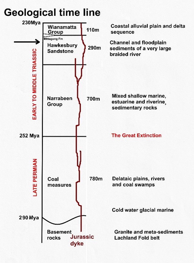
The Hawkesbury Sandstone has a maximum thickness of 290m. About 100m is exposed on the Lambert Peninsula, but just across Pittwater at Barrenjoey there is only 30 to 40m. The same rock was quarried for dimension stone at Pyrmont and used in many heritage buildings such as Sydney Town Hall and Queen Victoria Building.
Thicker shale beds have been quarried for clay and the grey shales have yielded rich fossil fish and insect faunas at Beacon Hill and Gosford. The sandstone contains few fossils.
On the lowest slopes and around the shore of Pittwater older sedimentary rocks of the early Triassic Newport Formation support tall spotted gum (Corymbia maculata) forests but the rocks themselves are harder to see except where exposed in stream beds and waterfalls and near the shore line. Visitors wanting to inspect these strata should use geotrails along the Northern Beaches coast such as Long Reef.
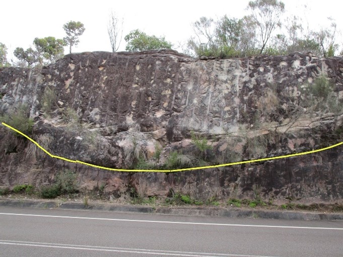
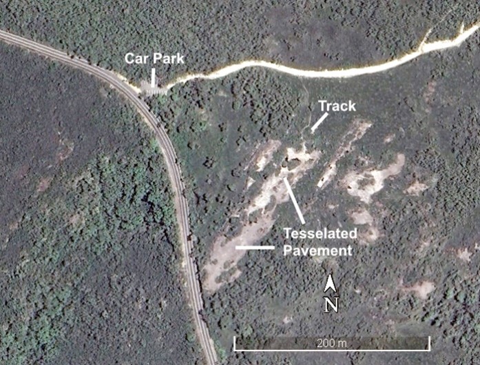
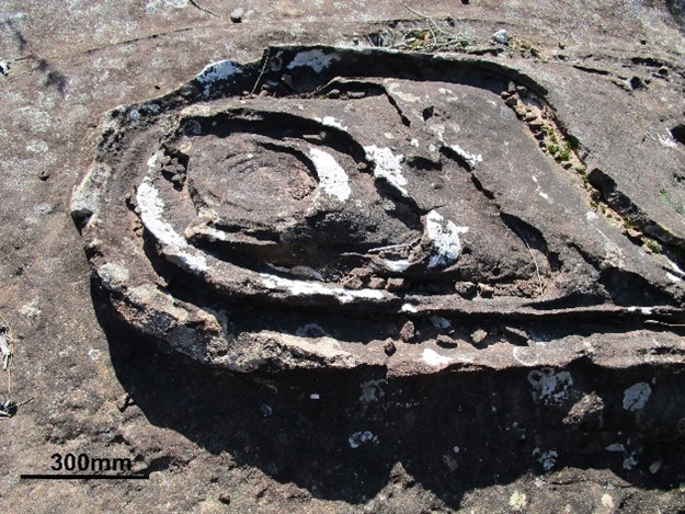
Geosite 1. Elvina Track car park
Use the parking bay on the right-hand side 1.2 km from the start point. Walk 150m along the Elvina fire trail through open woodland and heath, then turn south on an unmarked track for about 80m onto a large open rock platform.
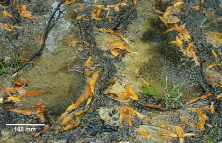
This platform has an extensive tessellated pavement, numerous vegetation islands, and a number of Aboriginal rock engravings. The tessellations occur on a body of massive sandstone that has a distinctive channel cross section visible in the road cutting 100m south of the car park.

Cross section of the channel filled with massive sandstone.
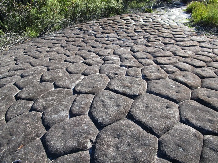
Typical polygons of the tesselated pavement
The tessellations only extend 10 to 20cm into the sandstone and vary in size and shape. Many have shallow pits on their surface, some of which may have a human origin.
We know little about the engravings other than to describe what we see. Outlines of fish and wooden shields are present. A large emu stands adjacent to a humanoid figure that is said to depict a supreme being called Daramulan. In some stories Daramulan is the son of Ngalalbal the emu.
Nearby is an outline of a whale, and elsewhere on the rock platform two parallel natural lines have been enhanced by a number of cross lines with the whole representing … what? You decide, we do not know, and should not attempt to impose our interpretations on something that clearly has Aboriginal significance which has not been revealed.
Several explanations of the tessellations have been proposed. Initially the patterns were likened to columnar joints often seen in volcanic rocks and it was suggested that this site may be close to a volcanic neck (diatreme) or igneous dyke. No igneous rock is present and the tessellations are only a surface feature with little depth. A second hypothesis compared them to ice wedge polygons as seen in tundra regions, but this is also untenable as the environment was never cold enough for ground freezing. The third hypothesis compared the tessellations with craze patterns on ceramic tiles. Such stress relief failures may be a better explanation considering that the patterns are found in thick bodies of massive facies sandstone that was dumped in a single large flood event and then buried by as much as 1,000m of younger sediment. When eventually exposed at the surface, superficial crazing could be an expression of stress relief. In this model the cracks would be the result of expansion, not shrinkage.
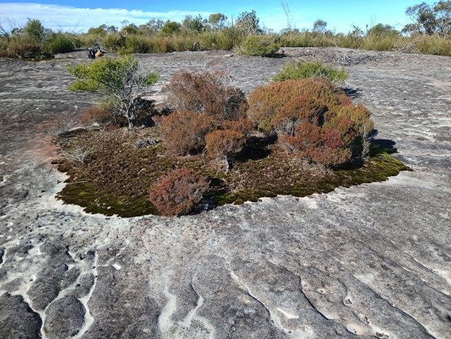
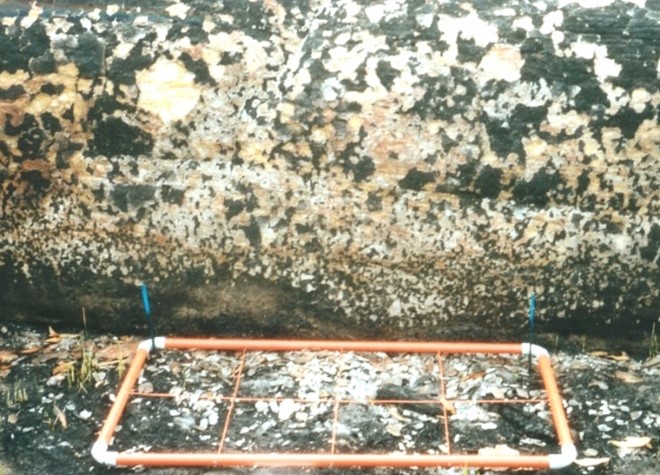
Vegetation island
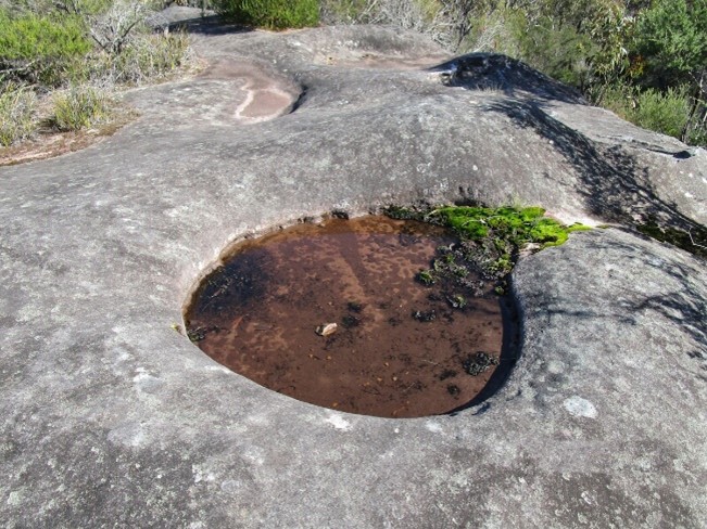
Solution pan or eroded island
Any irregularity on the rock surface that allows washed sand or gravel to accumulate will begin to support plant life. It starts as a denser growth of algae and crustaceous lichens, then progress to carpets of moss and foliose lichens. In time, more sand is trapped and organic matter builds up, then the patch of vegetation can support higher plants. The vegetation islands are a dynamic environment. During dry times the mossy edges lift off the sandstone. Every shrinking phase removes a thin layer of sand from the rock surface and as the islands enlarge, plant roots weather the sandstone, creating a soil profile. Many islands are sufficiently isolated that they do not burn as frequently as denser plant communities near the edge of the rock outcrop. Other semi-circular pits fill with rainwater and have two possible origins – solution pans in which the sandstone has been planed-off by frequent wetting and drying or, former vegetation islands that have eroded. Such empty pits have been named ‘snames’ and were suggested to be the location of hot fires intended to illuminate rock engravings, an idea which is untenable as most are too distant from engravings to be effective.
Geosite 2. Salvation Creek car park
A small parking bay on the right-hand side 3.4km from the start point. The creek is accessible below the road bridge and contains small falls across sandstone beds and several pot holes. This is a likely location for Aboriginal axe sharpening grooves but none are evident.

Salvation Creek locations
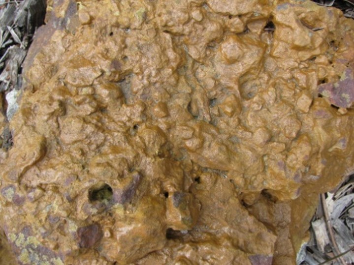
Laterite boulder
Several large blocks of ‘laterite’ have been used as vehicle barriers in the car park. This material came from a quarry elsewhere and are good examples of massive ferricrete which is now difficult to find. On the soil surface of most parts of the peninsula ironstone gravel of similar appearance has been described as ‘detrital laterite’ implying that the peninsula was once continuously capped by ferricrete like these blocks. Even a cursory inspection of the surface gravel will show that they are not the same material as the large blocks. There is a considerable literature on Sydney laterite much of which is controversial. The main outcrops occur on ridge tops south of Ku-ring-gai Chase and most sites have been destroyed by quarrying. The best location to see an intact section is adjacent to the tennis courts near the intersection of McCarrs Creek Rd and Yulong Ave, in Terrey Hills.
Geosite 2. Sedge swamp
There are several Coastal Upland Swamps in Salvation Creek, none of which are easily accessible. One can be glimpsed just upstream of the road. It is an endangered ecological community containing saw sedge (Gahnia aspera) swamp banksia (Banksia robur), coral fern (Gleichenia dicarpa), and button grass (Gymnoschoenus sphaerocephalus) growing in deep sandy peat. Basal organic sediments in the swamp have been dated to 5,150+/-200 years before present. Pollen analyses reveal that fire was present throughout the life of the swamp but sedges were replaced by coral fern and woody shrubs especially prickly tea-tree (Leptospermum juniperinum), about 2,500 years ago followed by a decline in Eucalyptus pollen 1,700 years ago. No explanation of these changes has been proposed.
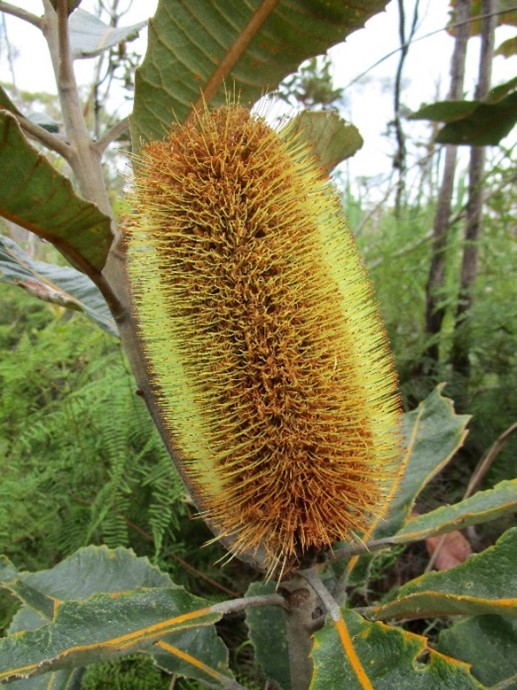
Banksia robur
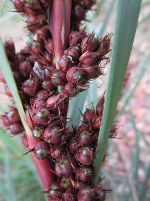
Gahnia aspera
Plants and sediments in and around this swamp are examples of the intimate links between the biosphere and soil formation. For example, the cutting edge of Gahnia leaves carry numerous sharp spicules of plant opal (amorphous silica - SiO2) taken up through the roots and deposited in cells. The solubility of silica in water is extremely low, but the silica content of leaves in local swamps can be as high as 2.5% by dry weight. When the plant tissue dies, the phytoliths become part of the swamp sediment and most of the mineral matter in the soil will be accumulated silt sized phytoliths.
Where tributary creeks carry sand onto the swamp margin alluvial fans and terraces form and support distinctive vegetation dominated by old man banksia (Banksia serrata), woody pear (Xylomelum pyriforme), Christmas bush (Ceratopetalum gummiferrum), and red bloodwood (Corymbia gummifera). All of these plants are involved in the formation of a special soil profile known as a podzol in which iron oxides in the soil parent material are dissolved and shifted down the profile to cement as iron pans. In Western Australia, other plant species in the same families have been linked to the formation of laterite similar to that seen in the car park.
An endangered species, the New Holland mouse (Pseudomys novaehollandiae), occupies colonial burrows in these sand bodies where it was rediscovered in 1967 after having been missing, presumed extinct, for a century. Populations of this native rodent are linked to fire frequency. Numbers peak 2 to 4 years after a burn and they may go locally extinct after 10 to 12 years without a fire.
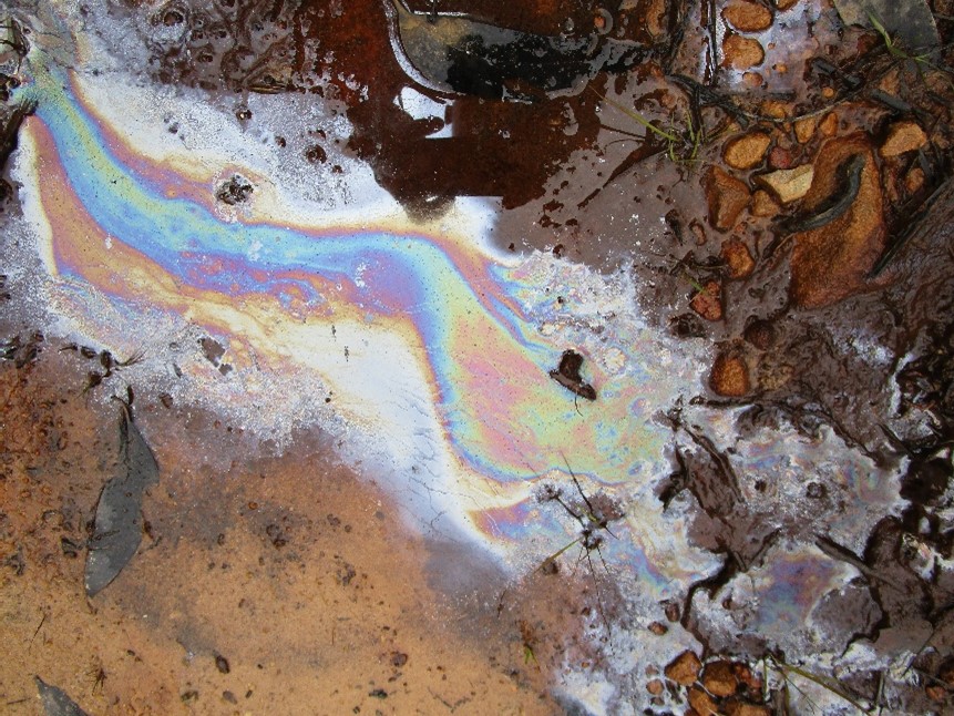
Geosite 3. Seepage precipitating iron oxides
Walk about 200m up the Salvation Loop fire trail which begins on the northern side of West Head Road 200m beyond the bridge. Heathland areas on the upslope side of the trail drain toward the swamp. Where the fire trail is cut into the soil you can see active seepage or flow of soil water (depending on the time since last rain). This water carries iridescent surface films that are often mistaken for oil films or pollution. They are actually films of iron oxides and dead bacteria. If you gently stir one, the film breaks up into angular fragments and does not remain intact and swirl like oil.
This time it is not the higher plants shifting iron, but bacteria. At least 18 species are able to derive their energy by metabolizing iron. The chemistry is complex and operates under anaerobic conditions such as found in saturated soil (these heathlands). When soil water containing dissolved ferrous iron contacts the atmosphere it is converted back to ferric iron which precipitates as ferrihydrite (hydrated iron oxide) and combines with dying bacteria as a rusty sludge which can cement sandstone rubble and soil on the track surface.
Do higher plants benefit from these bio/geo chemical links? Undoubtedly, but we only have glimpses of the connections. One probable example involves the availability of phosphorous in nutrient poor soils such as those formed on Hawkesbury Sandstone. What little phosphorous is present is ‘locked up’ on ferric iron and not available to plants. When bacteria, fungi or plant exudates temporarily shift the iron to the ferrous state then higher plants can ‘snatch’ the liberated phosphorous.
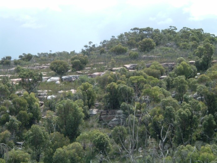
High points along the road toward Geosite 4 provide views of typical benched topography of the Lambert Peninsula. These rock steps are important elements in shaping the soil mantle, controlling surface hydrology, and vegetation patterns, because they shed rainwater and sediment into the adjacent soil and locally increase water availability to the plants.
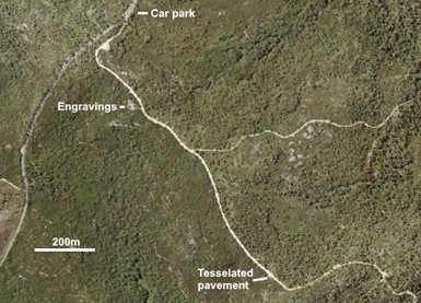
Geosite 4. The Basin Trail
Use the parking bays on the right-hand side, 8.6km from the start. Walk 360m along the Basin Track to a marked access point for Aboriginal rock engravings.
Notice the difference in the vegetation on either side of the fire trail. Fire trails are used as boundaries for hazard reduction burns and the two ages of regrowth have different structure and some species change. Plant communities growing on Hawkesbury Sandstone are very tolerant of bushfires and have numerous survival strategies, examples can be found at any geosite. These include:
- Shrubs, grasses, sedges, and ferns that simply regrow after fire because their growth points lie beneath the soil.
- Trees and shrubs that resprout from dormant buds beneath the bark (epicormic shoots), or send out new trunks from the tree base (lignotuber).
- Species in which flowering and seed production is stimulated by smoke.
- Plants which store seed in woody capsules held in the canopy, and others that drop seed frequently and rely on soil storage.
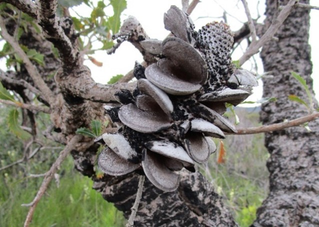
Fire responses. Left: Gahnia growing from protected growth centres, Banksia woody fruits protected the seeds and opened after fire, Actinotus helianthi germinates and blooms prolifically after fire from soil stored seed.
Fire is a natural part of this environment and also affects rock and soil. Moist rock can spall and shatter when heated. Intense heat from burning logs sterilises the soil which may take 2 to 3 years to recolonise. Every fire liberates a pulse of nutrients from burnt biomass. Storm runoff after hot fires may cause erosion which can be self-limiting as the remaining litter and scorched leaves form into small dams that trap washed sand and encourage seed germination. In understanding fire relationships, we work with the concept of a fire regime – frequency, intensity and timing, but we must also appreciate that today’s regime is not the same as it was under Aboriginal management, and that it also changed in the longer term as climates shifted.
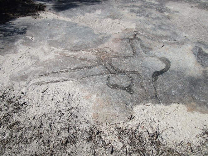
The rock engravings at Geosite 4 are typical of many sites and include about 40 figures and part figures. Profile views of fish and wallabies, as well as male and female figures associated with shapes that may be the crescent moon. A few mundoes (footprints) are also visible.
The tesselations here are larger than those at Geosite 1 and have fewer cupules. The site is frequently visited and unfortunately engravings are occasionally vandalized. Consequently, this site receives more management attention and the engravings are sometimes enhanced by Aboriginal teams using narrow nylon brushes and water to remove lichen.
Geosites 5, 6, and 7. Resolute picnic area car park
Park in the Resolute picnic area on the right-hand side 11.1km from the start. Parking is limited in these areas and the site can be busy on weekends.
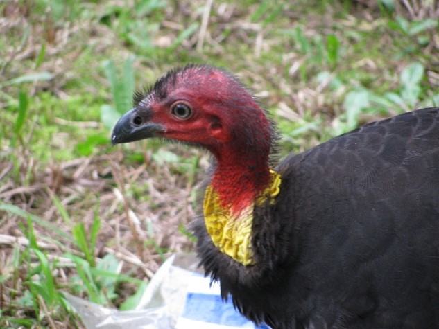
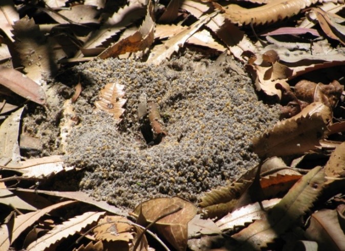
Here you will see Australian brush turkeys (Alectura lathami), one of the incubator birds (megapodes) which rake up substantial mounds of leaf litter and surface soil in which to lay their eggs. The male does all the construction, raking litter to bare soil for 15 – 20m around the mound, providing a feast for kookaburras and others, then keeping the mound temperature close to 340C by frequently exposing or covering the egg chamber. The female lays her eggs, the male monitors the site and 50 days later the young dig their way out of the mound and are immediately independent. The population of these birds has increased across northern Sydney in recent decades and moved south – is this an effect of climate change?
Glossy black cockatoo (Calyptorhynchus lathami), are often heard feeding in the forest oaks (Allocasuarina torulosa), goannas (Varanus sp.) and laughing kookaburras (Dacelo novaeguineae) may visit your picnic table to ‘steal’ food.
Geosite 5. Igneous Dyke
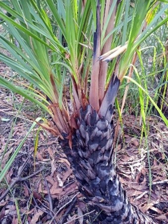
Road cuttings west of the car park expose a deep, red clay soil derived from an igneous dyke, no fresh rock is visible. The dyke is a vertical sheet of dolerite intruded through the entire sedimentary rock sequence. This one is 8 to 10m wide and can be traced on air photos at least 20km from Barrenjoey to beyond Barr Island. This soil carries different vegetation including turpentine (Syncarpia glomulifera), large-fruited red mahogany (Eucalyptus scias), smooth-barked apple (Angophora costata), grey gum (Eucalyptus punctata), cabbage tree palm (Livistona australis), broad-leaf grass tree (Xanthorrhoea arborea), and burrawangs (Macrozamia communis). It is usually assumed that these plants are responding to higher soil nutrient levels, especially phosphorous. However, some soil analyses suggest nutrients are not greatly elevated and that better soil moisture conditions and greater soil depth may be sufficient explanations of the differences.
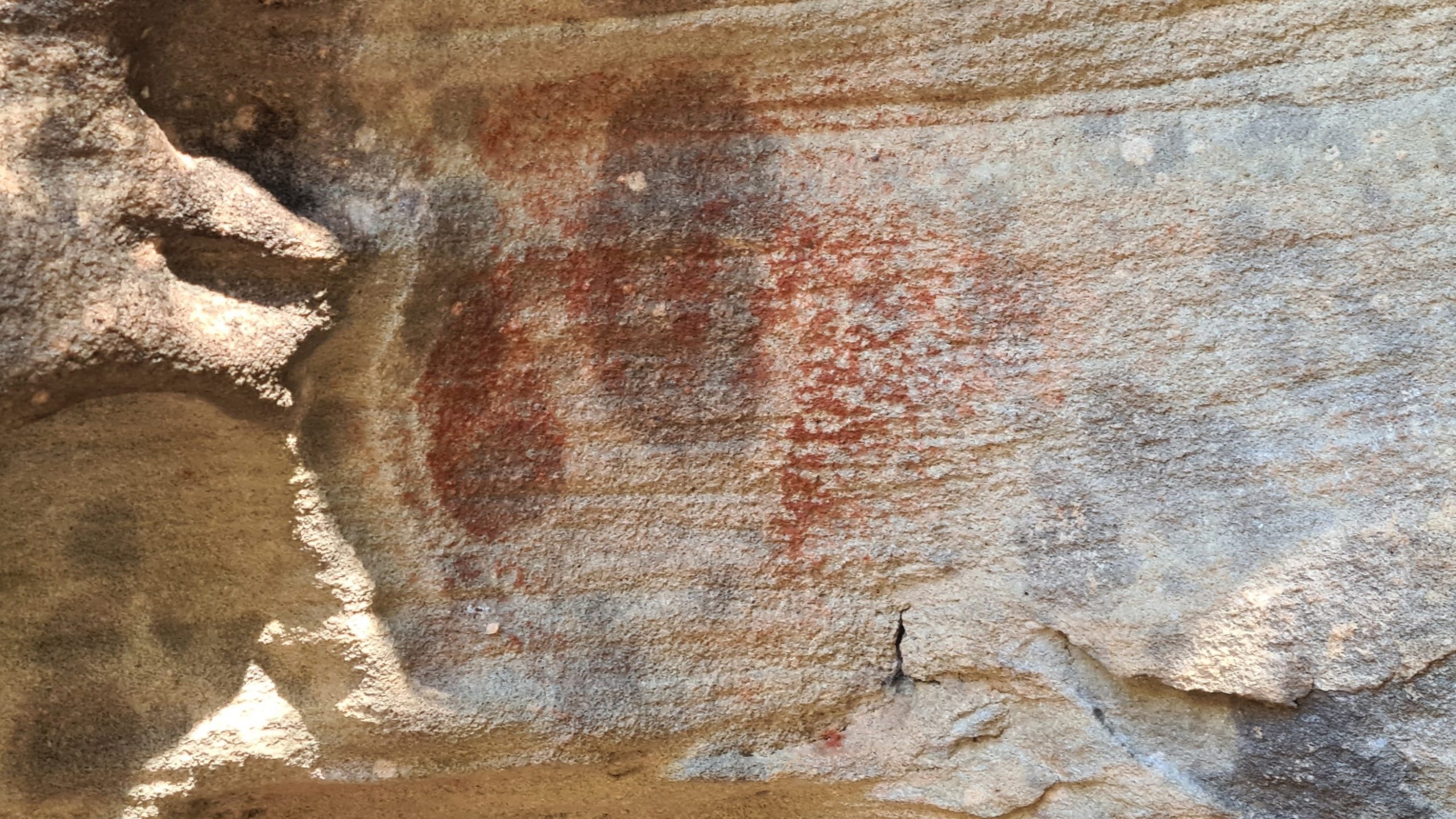
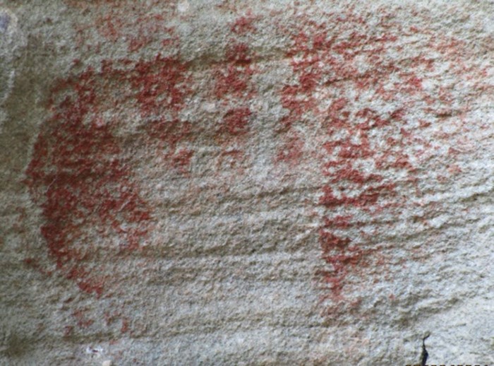
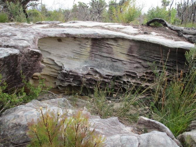
Geosite 6. Red Hands Cave
The track is signposted at the south east corner of the picnic ground. Walk about 80m to Red Hands Cave. Search the shelter walls to find a number of red ochre hand-stencils. We have no date on this art site other than to recognize that the stencils are >200 years old. Other dated sites in this environment do not extend beyond about 5,000 years although Aboriginal people have been in Australia for more than 50,000 years. A possible explanation of this anomaly may be that for much of that time this site was further from the richer food resources of the coast than it is today.
What is the meaning of the art? Perhaps it is simply ‘I was here’, or it may have greater significance. One telling point could be that this shelter has no occupation debris on the floor – it was not lived in, so may be important in some other way.
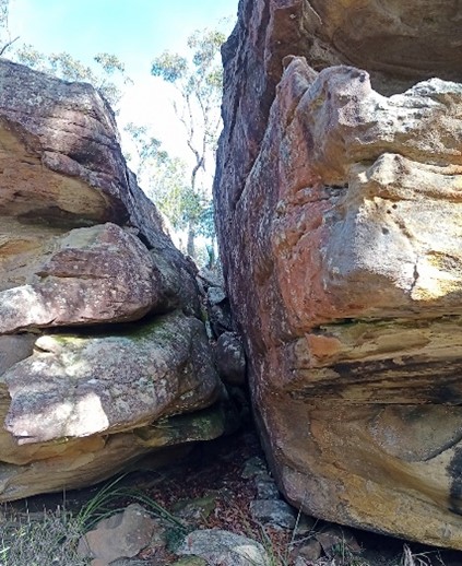
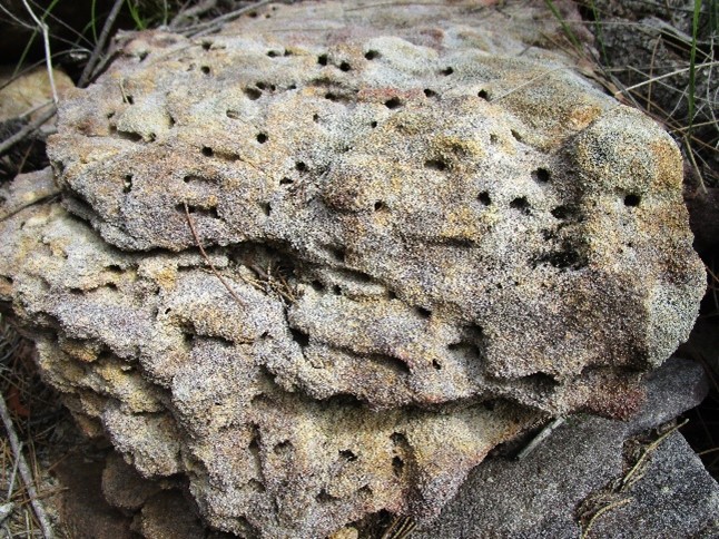
The mass of sandstone forming this shelter is breached by a wide, open joint which is partly filled with plant litter from upslope and a few chock boulders. The two faces of this joint are separated about 80cm indicating that even blocks as large as this are slowly moving apart and drifting downhill.
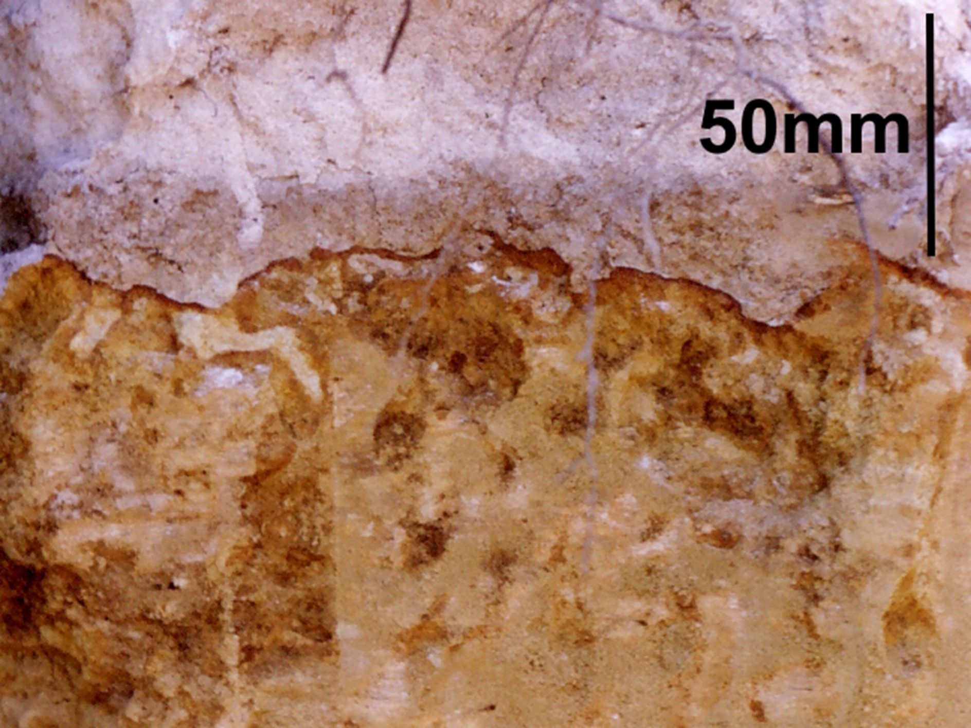
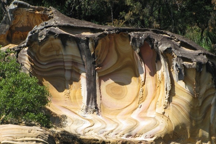
The shelter is a typical cavern weathered into an outcrop of sheet facies sandstone. Patterns of cross bedding are evident, much of the surface is ‘case hardened’ by secondary deposition of silica, and where this thin skin is breached, softer and more brightly coloured sandstone is exposed. The red/yellow colours are due to iron oxide and often form complex concentric and overlapping patterns now referred to as ‘ferruginous banding’ (previously described as liesegang rings). In fresh sandstone a common cement is siderite (iron carbonate), which imparts a grey/green colour to the rock. In the weathering zone siderite breaks down to iron oxides (goethite, limonite and haematite) and often forms concentric (onion skin) layers. Where these patterns are exposed on rock surfaces the iron rich layers can form intriguing features.
Geosite 7. Resolute Trail rock engravings
Return to the Resolute Trail and proceed 420m to a small rock platform adjacent to an information sign and search for Aboriginal rock engravings. School groups are taught to remove their shoes to limit damage to the rock surface, you could too. A man with outstretched arms with a club or perhaps an axe at his waist is easy to spot. Less clear is a leg beneath the man’s right leg which is a remnant of an earlier engraving. Close to the man’s head are two eels with their bodies divided by cross bars. Looking closely at the eels and you will see that the engraving began as a series of conical pits that were then joined as a line. Search the rest of the rock outcrop and you may find a partial fish and a few traces of older works which are not identifiable. The platform also has numerous small sandstone solution features, shallow pools, with manganese, iron and silica staining around the margins, and active moss mats.

This site is right beside the fire trail and it is possible that other engravings were destroyed when the trail was constructed. Similar damage is seen a further 125m along the trail where other engravings are protected behind some large boulders.
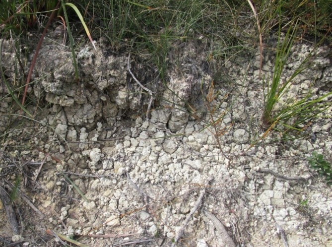
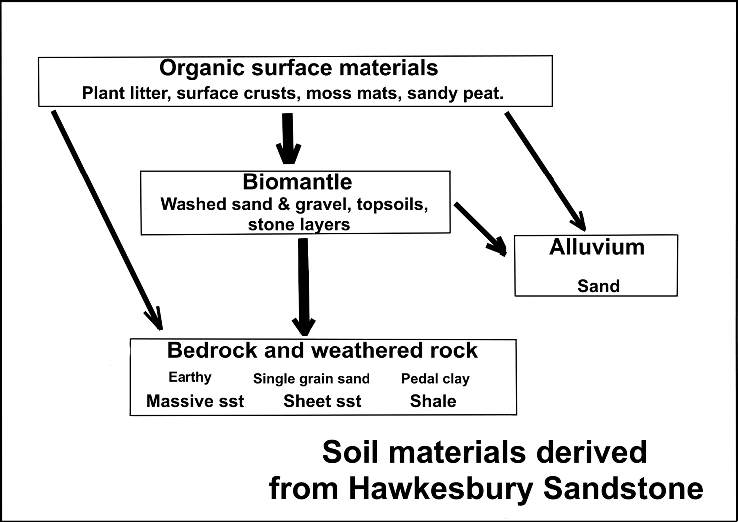
Continue another 300m past the second set of rock engravings and several shallow caverns in sheet facies sandstone, then down the first steep section of the trail onto a bench where you will find a subsoil of blocky white clay exposed in the table drain. This is the weathered product of a thin shale bed which forms the bench. Notice that the topsoil is not clay but a thin veneer (biomantle) of sand that has washed over it from upslope. Soils like this are described as texture contrast or Duplex profiles and are best understood as being two discrete layers rather than conventional A, B, C, horizon soil profiles.
The table drain usually holds water and a spot like this could be habitat for the vulnerable red-crowned toadlet (Pseudophryne australis). On the way back to the car park look for other signs of animal interactions with the soil; bandicoot feeding scrapes, ant mounds, termite nests, litter scratched by birds, and perhaps some echidna feeding scrapes. All of these activities, and more, are constantly churning the topsoil, exposing it to rainwash erosion, and contributing to creation of the soil biomantle.
Geosite 8. West Head Lookout
To reach the lookout you may walk down the Red Hands Cave trail (1km), or drive closer. Parking is limited.
The Lookout gives magnificent views over Pittwater to Barrenjoey and over the mouth of the Hawkesbury River to Lion Island where there is a penguin colony. On Barrenjoey the full sequence of the Hawkesbury Sandstone is visible in the cliffs above the Narrabeen Group sedimentary rocks. At sea level on the northern face, you might just make out a line of black rock which is an outcrop of the dyke seen at Geosite 5. The rock here is unweathered (fresh) and has been dated using the Potassium/Argon decay ratio as being 173 +/- 3 million years old, or early middle Jurassic. Flakes of this rock have recently been recorded in Aboriginal sites on the Palm Beach peninsula. If you have binoculars or a telephoto lens on your phone you may see activity in the seal colony near the dyke outcrop.
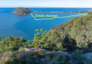
Geologically the most important feature of this view is that 20,000 years ago it would have been across a forested valley and the coastline would have been 8 to 12km offshore. Global sea levels rose rapidly after the last Ice Age from 120m below present to about 2m above present in the period from 18,000 to 8,000 years ago, drowning a landscape that was occupied by Aboriginal people. The narrow sandy isthmus that now links Palm Beach to Barrenjoey (a tied island or tombolo) fills the 70m deep valley of McCarrs Creek.
During the last glacial climate from 28,000 to 18,000 years ago the average global temperature was 6 to 7°C colder than today, rainfall in Sydney was lower, and the atmospheric CO2 level was about 180 parts per million (ppm) compared to 423ppm today. The exposed coastal plain would have been a complex of low rocky ridges, intersected by creeks and broad areas of coastal sands. With the lower rainfall and colder conditions, the vegetation would have been woodland and scrub patches with coastal heaths like those found further south today. This recent vegetation change can be interpreted through numerous examples of modern disjunct distributions of particular plants such as; wallum banksia (Banksia aemula) and button grass (Gymnoschoenus sphaerocephalus).
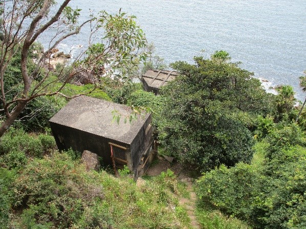
Geosite 9. West Head Battery
In the early 19th Century this headland was privately owned and in 1931 some 259ha was proposed as a 500 lot Country Club development advertised as; ‘The Beautiful Riviera’. Economic conditions were poor, sales failed, and the land reverted to the Crown for defence purposes.
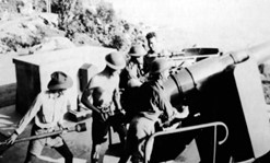
In 1941 the West Head Battery fortifications were constructed. Two 4.7” naval guns were set in concrete fortifications plus observation posts, searchlights, stores, lesser gun points, and an anti-submarine net stretched across Pittwater. All designed to protect Sydney from invasion via Broken Bay. Access to the base of the cliff was down a double, counter-balanced rail line on a 50o slope that occupied a ‘natural cleft’ in the cliffs. The heritage gun emplacements can be reached via a steep walkway which starts at the beginning of the road loop. Allow one hour for the round trip.
Conclusion
We trust that you have enjoyed these Geosites. If there is a ‘take home’ message it is surely about the complexity of the connections between, rocks, soil, organisms, and environmental conditions. The Lambert Peninsula today is not the same as Du Faur knew it, not the same as Aboriginal people of 20,000 years ago knew it, and it will not be the same for your great-grandchildren. Change is always with us
Click here for a West Head Geotrail PDF for further reading.