The Sydney coast is a seemingly endless succession of bold sandstone headlands and cliffs punctuated by white sand beaches. Long Reef, 17km northeast of the city is an exception, the cliffs are subdued and surrounded by wide shore platforms formed on Triassic claystone 245 million years old. The shore platforms have innumerable crevices and pools that support a rich diversity of inter-tidal life. The rocks reveal stories about sediments and fossils deposited on the edge of Gondwana when this part of Australia was 30 degrees further toward the South Pole than it is today.
Introduction to the stratigraphy
Coastal cliffs along the northern beaches reveal a full sequence of early Triassic sedimentary rocks deposited near the top of the Sydney Basin. Coastal flexures have juggled the layers in each headland and by tracing individual strata from one headland to the next the full sequence is revealed. The oldest exposed rocks are the Bulgo Sandstone (~248 million years ago). A small outcrop occurs at Long Reef. The youngest sedimentary rocks are lower parts of the Hawkesbury Sandstone (~240 mya), a competent and well cemented quartz sandstone seen in the whole cliff at Dee Why Head and in the highest parts of Bangally and Barrenjoey Heads.
Between the Bulgo and Hawkesbury Sandstones there are three units belonging to the Upper Narrabeen Group:
- Newport Formation – lithic sandstones, shales and occasional conglomerates which differ from the Hawkesbury Sandstone rocks and which were deposited in a delta by streams flowing from the New England region.
- Garie Formation – grey-green clay-pellet sandstone, siltstones and claystone less than 8m thick that contains volcanic ash. The ash is important because it would have been deposited right across the Triassic landscape and should provide a positive means of correlating outcrops from Garie to Mona Vale.
- Bald Hill Claystone - red and grey claystones (mud-rocks), which fret readily on wetting and drying. They contain a range of fossils and trace fossils that suggest the mud was deposited in an estuary.
Turimetta Head
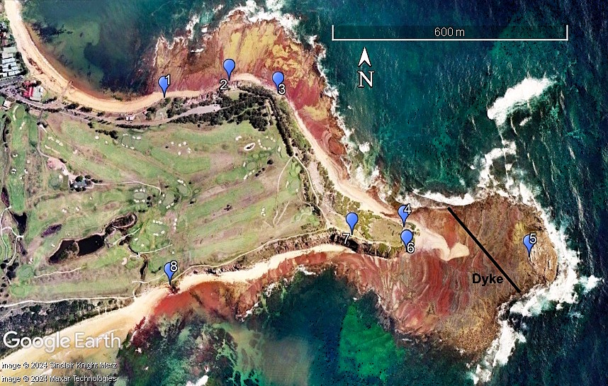
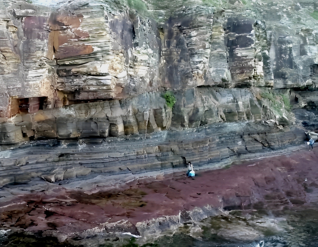
Shore platform of red-brown mudrock of the Bald Hill Claystone overlain by the alleged Garie Formation with a clear boundary to lower Newport lithic sandstones. This headland is on the Woolloomooloo fault zone and is probably the most unstable cliff in Sydney. Heavy rainfall and high seas can trigger big rock falls but small events can occur at any time.
Avalon North Head
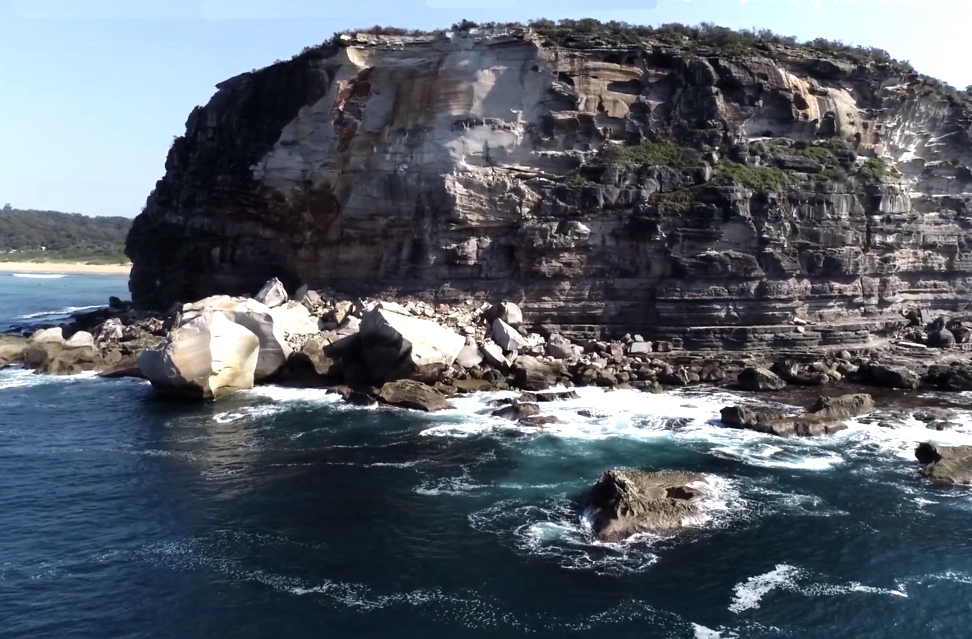
Avalon North Head is 63 m high and all Newport Formation. On 11 August 2017, some 6,000 to 8,000 m3 of rock fell into the sea at dusk. This cliff has seen many falls that destroyed features like ‘Hole in the Wall’ and the ‘Stone Lady’ over the last 100 years and it will fail again, as it is probably on the Luna Park fault zone.
Bangally and Careel Heads
The cliff along Careel Reserve is 80m high in Newport Formation sandstones and siltstones. The shore platform barely exists, and this section of coast is inaccessible.
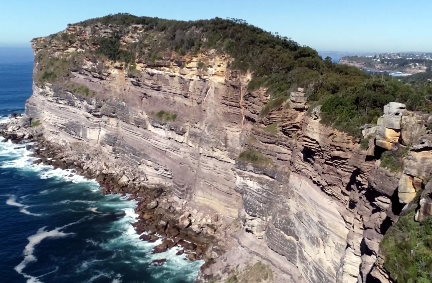
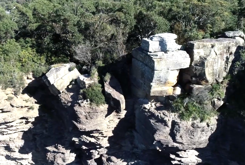
Very large blocks of Hawkesbury Sandstone rest precariously on the cliff margin.
Barrenjoey Head
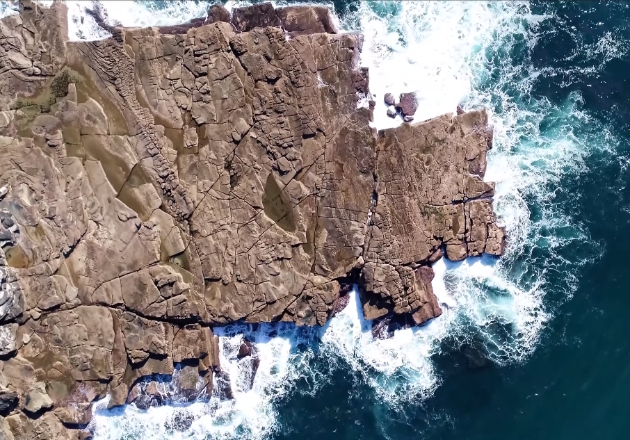
The shore platform at the base of Barrenjoey Head exhibits a strong joint pattern in Newport Formation sandstone.
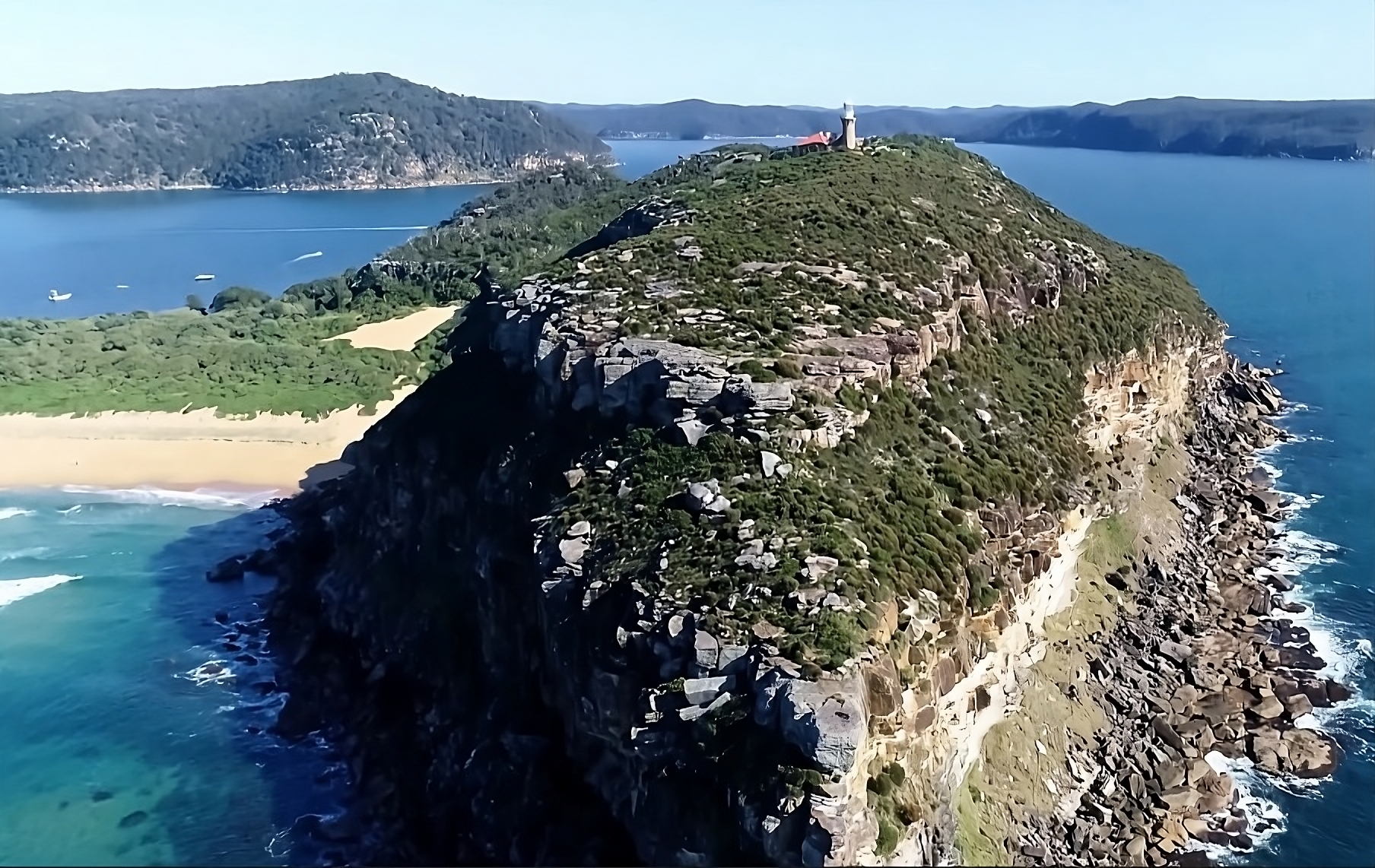
View of Barrenjoey looking across Pittwater to West Head. Newport Formation rocks extend up to the vegetated bench and then pass into Hawkesbury Sandstone. Plants on this exposed point are a distinctive coastal association. The lighthouse was built of local Hawkesbury Sandstone in 1881 and can be visited via a service trail from the end of Palm Beach. The sand peninsula (tombolo) of Palm Beach buries a 70m deep bedrock channel eroded by McCarrs Creek during periods of low sea level during the Ice Ages.
Warning
Most headlands are high risk environments subject to variable tide heights, extreme waves, and large rockfalls. Tracks established by fishers and rock climbers are often unstable and dangerous. The best way to appreciate this challenging landscape is to visit the Long Reef Geotrail and to view drone imagery as illustrated here.
Long Reef Coastline
For most of the time when Garigal clans of Aboriginal people lived here, Long Reef was just another forested ridge extending 10-15km offshore as sea level was 120m lower than present. The sea returned to its present position about 7,000 years ago and formed the headland and shore platform we see today.
Come take the walk and learn more.
Click here to discover the Long Reef Geotrail.