logo colouricon colourlogo colourlogo colour
  • Home
  • About
  • Geosites
    • Sandstone Plateaus
    • Triassic Coast
    • Drowned Valleys
    • Forests, Heath & Swamps
    • Jurassic Diatremes
    • Igneous Dykes
  • Partners
  • Aboriginal Heritage
    • America Bay
    • Blackfellows Head
    • Red Hands Shelter
    • The Basin Site
    • Wakehurst Parkway
    • Elvina Trail
    • Grotto Point
    • Moon Rock Engraving
    • Resolute site
    • Whale Feast Site
    • Bobbin Head Track
  • Fauna
    • Amphibia, Fish & Marine Mammals
    • Birds
    • Invertebrates
    • Mammals & Reptiles
  • Resources
    • Published Materials
    • Presentations
    • Videos
    • Teacher Guides & Information for School Visits
    • Articles
    • Reference Materials
  • Projects
  • Contact us
✕

Articles
April 11, 2025

Introducing the Ku-ring-gai GeoRegion

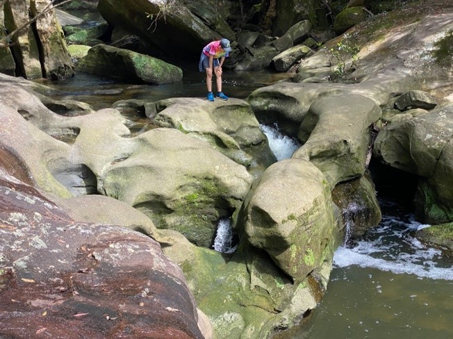
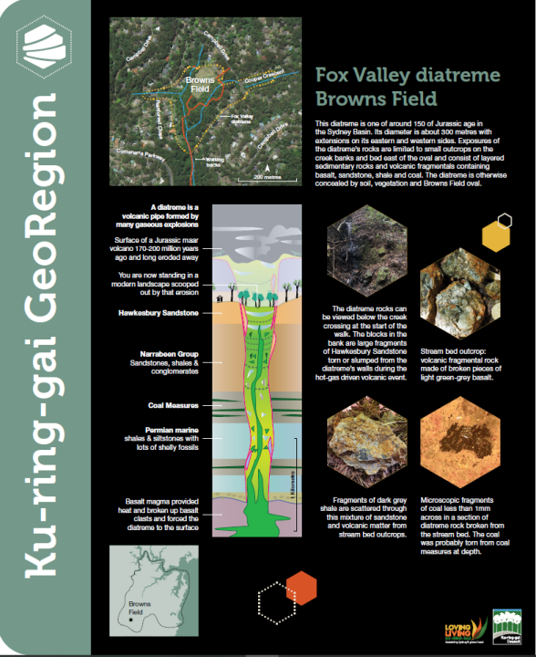
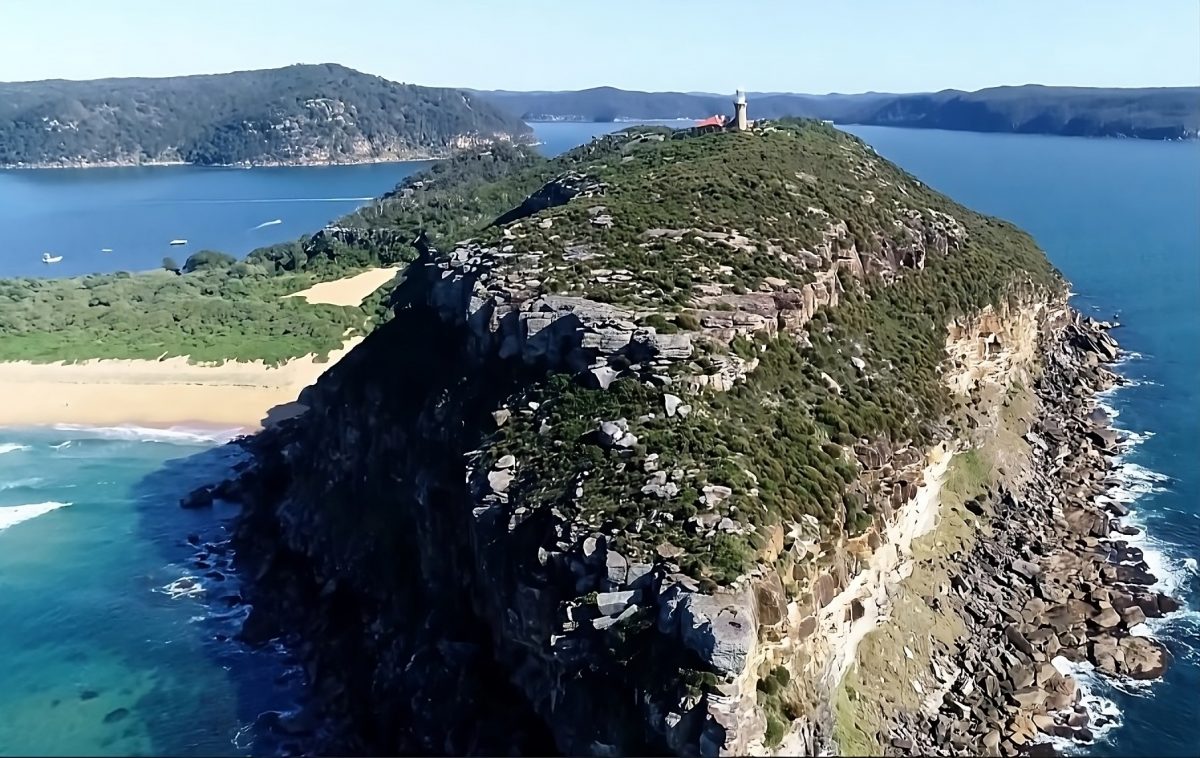
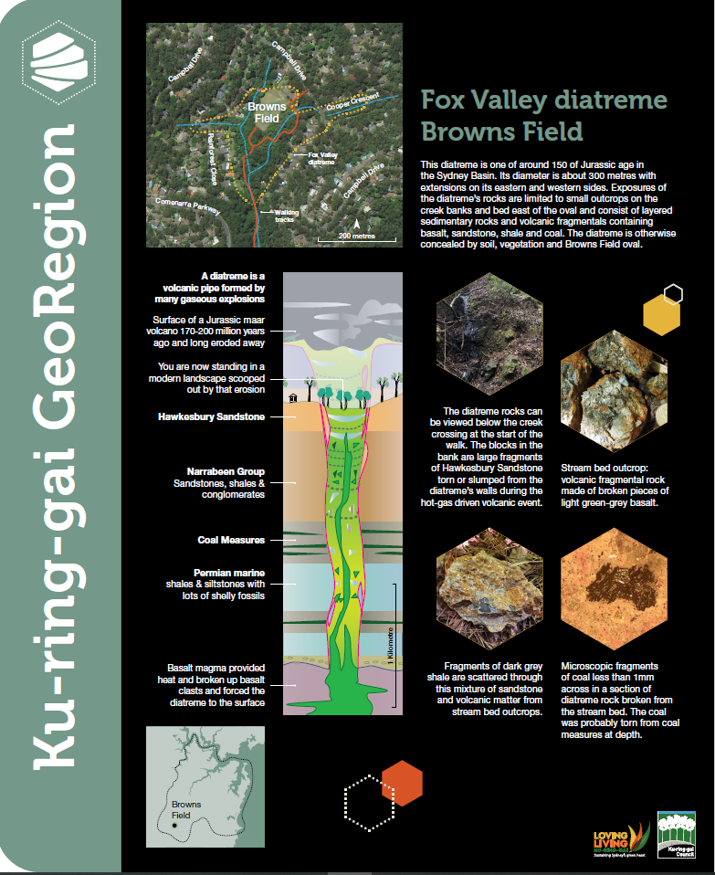
Welcome to the Ku-ring-gai GeoRegion, a large area of 440km2   just 40 minutes north of the Sydney CBD. Fascinating rock formations, stunning viewpoints, coastal, forest and […]
Do you like it?
Read more
April 11, 2025

Autumn is the best time to visit the GeoRegion!

Going for a walk in Autumn is a fantastic experience for several reasons. The season brings cooler, crisp air that makes hiking comfortable and refreshing, without […]
Do you like it?
Read more
April 8, 2025

Coming Soon! Guided Walks & Zoom Talks

We are currently putting together a series of Guided Walks and Talks to introduce people to why the Ku-ring-gai GeoRegion is so special to Sydney and […]
Do you like it?
Read more

An extensive area north of Sydney that showcases the geological evolution
of the area that forms a major part of the Greater Sydney Basin.

LET'S CONNECT

  • Facebook
  • Instagram
Website developed with a Directors' Grant
provided by the Community Bank - Lindfield & Districts


© 2025 Ku-ring-gai GeoRegion | All Rights Reserved | Made with ♥︎ by Nightly