
'The host country of Blue Gum High Forest consists of gentle, rolling upland watersheds formed on the relatively soft and more phosphorus rich Ashfield Shale Formation of the Wianamatta Group. Key reserves that protect this plant community include Sheldon Forest, Dalrymple-Hay Nature Reserve and Cumberland State Forest. Ashfield Shale grades down into the low-nutrient Hawkesbury Sandstone via a layer of thin shales and sandstones called the Mittagong Formation. Helped by a high average rainfall, the Ashfield Shale beneath Sheldon Forest has generated deeper, richer soils than has the Hawkesbury Sandstone of the adjoining valley. The local interrelationships of geology, landscape and vegetation are illustrated in the section.
The Blue Gum High Forest plant community was named after its key tall-forest tree species, the Sydney blue gum (Eucalyptus saligna). Its second most common tall tree is blackbutt (Eucalyptus pilularis).
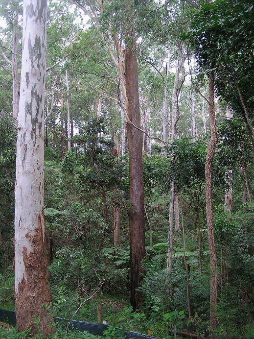
Blue Gum High Forest Sheldon Forest featuring Sydney blue gum (left), blackbutt (centre) and grey ironbark (right) with celerywoods and tree ferns
In Sheldon Forest, blue gum dominate, and other tall tree species such as grey ironbark (Eucalyptus paniculata) and smooth-barked apple (Angophora floribunda) are very few and scattered or localised. But let’s not confuse the picture by including the blackbutt forest that moves in southwards. Including it with Blue Gum High Forest might be a botanist’s view but it blurs some critical distinctions related to geology.
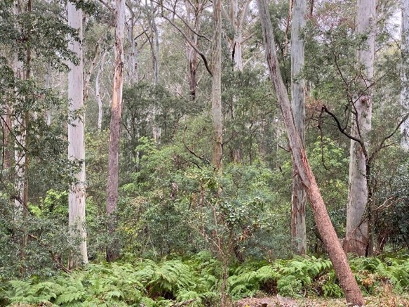
Blue Gum High Forest Dalrymple-Hay Nature Reserve with dominant Sydney blue gums
This forest, which downslope becomes richer in turpentines (Syncarpia glomulifera), is growing on Mittagong Formation, transitional down to the Hawkesbury Sandstone. It doesn’t really match the eucalypt flora of Sydney Turpentine-Ironbark Forest, and critically endangered Shale Sandstone Transition Forest with something like 25 eucalypt species is a better fit.
Before European settlement this forest community grew within an irregular arc of country across the North Shore where it intergraded with other forest communities such as Turpentine Ironbark Forest (TIF) or Sydney Turpentine Ironbark Forest (STIF). The fertile, accessible terrain over the shales encouraged clearing for orchards and dwellings in the earlier years of European settlement. Only a tiny fraction of the original, pre-European extent of Blue Gum High Forest now survives, as a series of small, isolated reserves and many of these suffer weed invasion helped by the higher soil fertility. Blue Gum High Forest was listed as critically endangered on 26 August, 2005, and one of the related forest communities, TIF, is also listed as critically endangered.
Click here to view the NSW DEPT of Environment and Heritage BGHF PDF.
But the value of these forests extends far beyond their conservation status. They are stunningly beautiful, irreplaceable and a priceless reminder of how the local landscape looked before European settlement and urbanisation. However their suburban locations mean they are especially vulnerable to human use, development pressure and weed invasion.
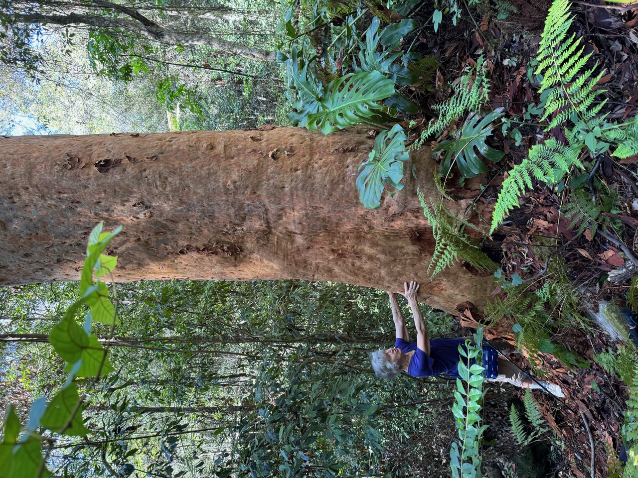
A very large Sydney red gum Abgophora costata growing in a valley cut in Hawkesbury Sandstone.
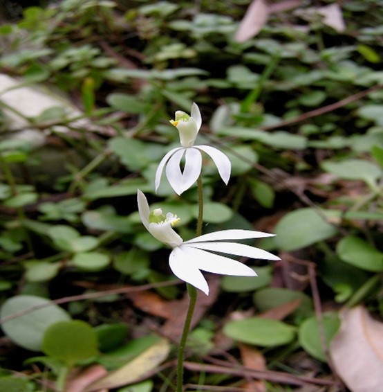
White finger orchid Caladenia catenata common in Springtime in both Sheldon Forest and Dalrymple-Hay
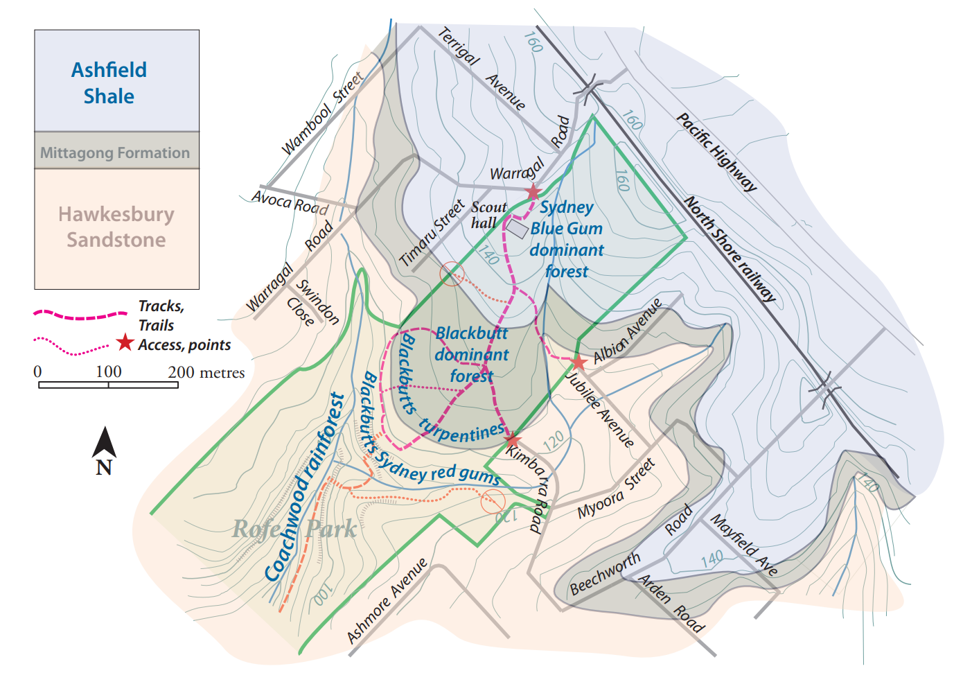
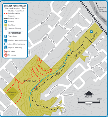
Access and Trail Map
Start at Warragal Road, Turramurra, off the Pacific Highway near the Scout Hall. You can also access the track from Jubilee or Kimbarra Avenues. Finish at Troon Place.
References
Herbert, C., 1979.The Geology and Resource Potential of the Wianamatta Group. Geological Survey of NSW Bulletin 25, 203pp
Herbert, C. and Helby, R. (Eds), 1980. A Guide to the Sydney Basin. Geological Survey of NSW Bulletin 26; 603pp.
Martyn, J.E. 2010. Field Guide to the Bushland of the Lane Cove Valley. STEP Inc., Turramurra, 248pp